![Drought, Wildfires and Monsoons in New Mexico [article image]](climate/jared-tarbell-climate-image.jpg)
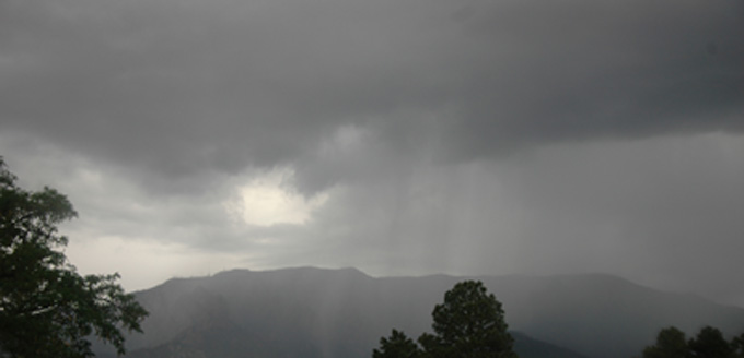
Monsoon season has arrived in the Land of Enchantment. That’s welcomed news given the fact that New Mexico has been rain starved for most of 2011. In Albuquerque, it continues to be the driest start to a year ever. And although rain has started falling somewhat, it has not been very robust considering the drought the region has been mired in this year.
But big climate anomalies are not out of line, considering the weather variability New Mexico has endured the past 10 years or so says University of New Mexico Climatologist and Earth and Sciences Professor Dave Gutzler.
“The last 10 years have been both somewhat dryer than the long term average, and also extraordinarily variable,” said Gutzler. “We’ve had some of the wettest years in terms of snowpack and monsoon rains, and also some of the driest years with a tendency toward dry conditions which have kept stream flows low and conditions pretty dry. We’re certainly seeing an extreme of that this year with almost no precipitation in the first half of the year at all in New Mexico.”
Conditions such as these take a toll on the environment, most notably the fire season in New Mexico, as well as in parts of Arizona. The Las Conchas fire in New Mexico eventually became the largest wildfire in New Mexico history scarring more than 156,000 acres before it was contained. New Mexico’s neighbors to the west, Arizona, also endured a record-setting fire, the Wallow fire.
“We’ve had a phenomenally intense wildfire season here this spring,” said Gutzler. “We expect wildfires in the spring. That’s the annual wildfire season here in the Southwest, but it’s been much worse than normal by 20th century standards so far this year.”
The fear with such a bad wildfire season is the fact that when the rains do come, and they have to some degree at this point in the summer, the erosion from the downpours will likely be much more devastating to the burn areas. Now that the Las Conchas fire has been contained, concerns turn to treatment projects including treatments to help stabilize soil, control water, sediment and debris movement, prevent devastation of ecosystems, and mitigate threats to health, safety, life and property.
“There are certainly intense local effects on an environment,” said Gutzler. “When we have big, stand-clearing fires, it wipes out the vegetation and mobilizes a lot of the soil so we set ourselves up for flooding and mass wastage when the monsoon rains kick in. Every year, typically around the end of June or early July, marks the end of the main wildfire season in the Southwest. When the rains start, the areas that have been denuded of vegetation are subject to flooding and sediment being moved down hillsides and canyons, and down into stream channels.”
Predicting the monsoon season is anything but a certainty says Gutzler, but he and other researchers, are currently looking into connections that might exist in connection with the wildfire and the monsoon seasons.
“Right now we are actively investigating possible ways to make predictions in advance of how intense the monsoon will be,” said Gutzler. “For over a decade, we’ve been looking at the possibility that land-surface anomalies associated with snowpack might affect the onset of the monsoon in such a way that when we have a deficient snowpack, like we did this year, then the continental surface can heat up quickly, and that can lead to an early onset and more intense monsoon.”
Conversely, the opposite can be true between winter and summer precipitation says Gutzler. The region, extending from southern Colorado into southern New Mexico, experienced very dry conditions last winter. Recent history suggests that this region might have an intense monsoon season this year, which happened in 2006 when the Southwest had the most intense monsoon on record.
Another factor in the determination of the severity of the monsoon season might have to deal with the wildfire season and the smoke produced from these fires. With the Wallow Fire in eastern Arizona extending into western New Mexico and the Las Conchas Fire in north central New Mexico, the significant amount of smoke produced might actually impede the onset of the monsoon season. This year, researchers have been able to gather much more data that relates to this theory.
“We’ve looked at the possibility that the wildfires themselves can also have some effect on monsoon precipitation,” explained Gutzler. “The theory there being that when you have smoke plumes that cover the surface across the southwest, like we’ve had this year, that can change the ability of the continent to heat up at the surface and change the static stability of the atmosphere and make it harder for rains to occur. We find, in the data, a suggestion that following intense wildfire seasons that monsoon precipitation might be a little bit suppressed.
“So we have contradictory signals from those two effects this year and quite frankly, we’re not sure which will win. Our own ability to make predictions in monsoons is very limited. That’s consistent with the National Weather Service, which has not been able to make a definitive monsoon prediction this year either.”
Global warming is yet another ingredient in the mix. With global warming, the southwestern part of North America is one of the regions that have shown a marked uptick in temperatures over the last several decades.
“We certainly expect a shorter snow season in the winter and earlier snow melt in the winter, leading to warmer and drier conditions in the spring. So one of the projections overall for climate change in the 21st century is consistent with what we are seeing in an extreme way this year,” said Gutzler. “All the things that go along with dry, warm conditions in the spring, we expect to see more of as the century progresses and the climate warms up, and that would include more wildfires.”
A big influence on New Mexico’s winter weather, and that of southern-tier of the United States, are the terms La Niña and El Niño, which describe ocean temperatures in the tropical Pacific. Based on historical research, and from theoretical modeling, these ocean temperatures in the Pacific affect the location of the winter time storm track quite significantly.
“When conditions are cold in the tropical Pacific, as they were this winter, we expect the winter time storm track to be pushed northward up toward the Canadian border,” explained Gutzler. “That’s just what we saw this winter. The fact that we’ve had such dry conditions this winter and spring is completely consistent with what we’ve seen in previous years when we’ve had La Niña conditions in the Pacific.”
The opposite is true when there’s an El Niño. Conditions then are warm in the tropical Pacific and that pushes the jet stream and the winter time storm track southward so storms that would ordinarily hit the Pacific Northwest tend to occur, on average, farther south where they hit California and points east like New Mexico and all the way along the southern tier of states.
“The dry conditions this winter and spring were probably related to the very strong La Niña that occurred earlier this year,” said Gutzler. “La Nina’s now over. It typically dissipates late in the spring and that’s what happened this May -- La Niña went away. We’re back close to normal ocean temperatures in the Pacific. Our ability to make climate predictions based on the seasonal time scale based on La Niña and El Niño has gone away for the time being until we see some ocean temperature anomalies reappear along the tropical Pacific.”
The anomalies tend to reappear in the late summer and autumn. Currently, a holding pattern is in place regarding El Niño and La Niña. The conditions are near normal and it’s hard to tell what will happen over the next few months.
“We tend to wait until the end of the summer to see how conditions are evolving in the tropical Pacific and that’s about the time we’ll start making a forecast for the winter,” said Gutzler. “We’re certainly hoping, considering how dry things are, that we might trend toward El Niño later this year. That would push the odds in favor of more precipitation and a better snowpack next winter. There’s no indication yet that that is going to happen, but we’ll just wait and see over the course of the summer.”
Image Credits
- Unitiled (drought image) © 2006 Jared Tarbell, used under a Creative Commons Attribution license: http://creativecommons.org/licenses/by/2.0/deed.en
- Untitled (wildfire image) © 2011 lasconchasfire3, used under a Creative Commons Attribution license: http://creativecommons.org/licenses/by/2.0/deed.en
- Untitled (monsoon image) © 2011 Jared Tarbell, used under a Creative Commons Attribution license: http://creativecommons.org/licenses/by/2.0/deed.en
