Assignment #3: Map Projections
1) Mapping the world
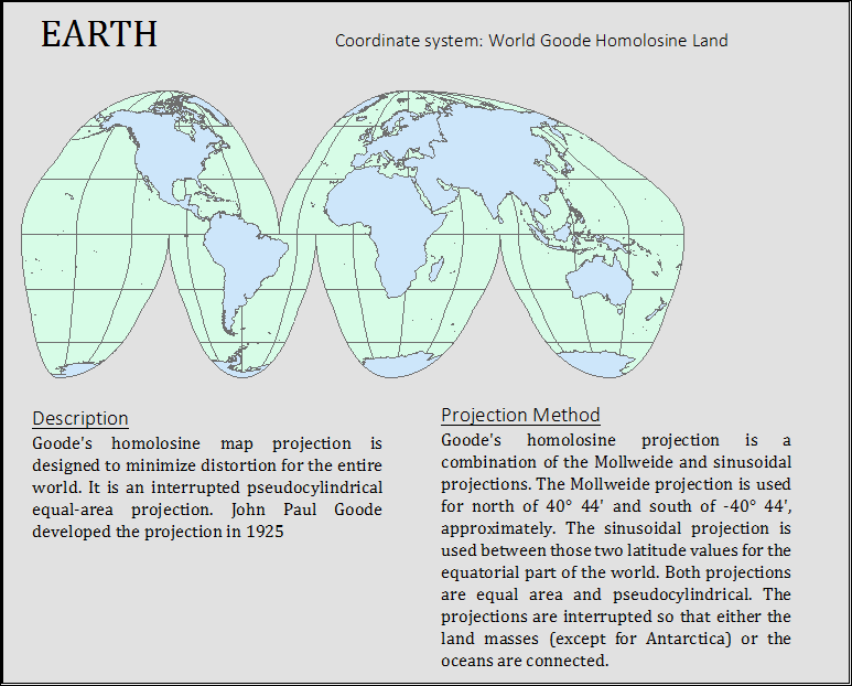
The map of the world has been projected using World Goodes Homolosine Land projection. Goode's homolosine map projection is designed to minimize distortion for the entire world. It is an interrupted pseudo–cylindrical equal-area projection. John Paul Goode developed the projection in 1925.
Goode's homolosine projection is a combination of the Mollweide and sinusoidal projections. The Mollweide projection is used for north of 40° 44' and south of -40° 44', approximately. The sinusoidal projection is used between those two latitude values for the equatorial part of the world. Both projections are equal area and pseudo–cylindrical. The projections are interrupted so that either the land masses (except for Antarctica) or the oceans are connected.
2) Mapping the United States
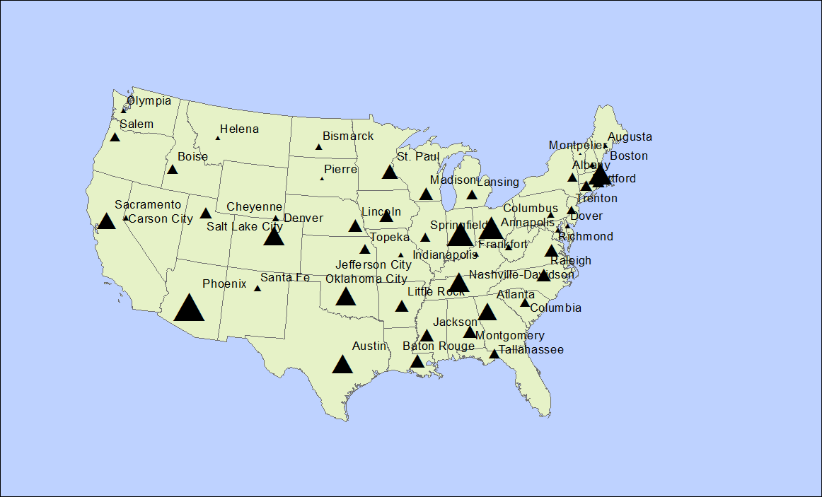
The second exercise involves mapping the United States and compare various information of different cities like distances and coordinates based on the projection selected. The distances between cities can vary depending upon the projection method selected.

The following are answers to selected questions:
a) Determine the approximate latitude and longitude of three cities
Ans:
|
City |
Latitude |
Longitude |
|
Santa Fe, New Mexico |
35.607 |
-105.972 |
|
Austin, Texas |
30.243 |
-97.776 |
|
Madison, Wisconsin |
42.99 |
-89.454 |
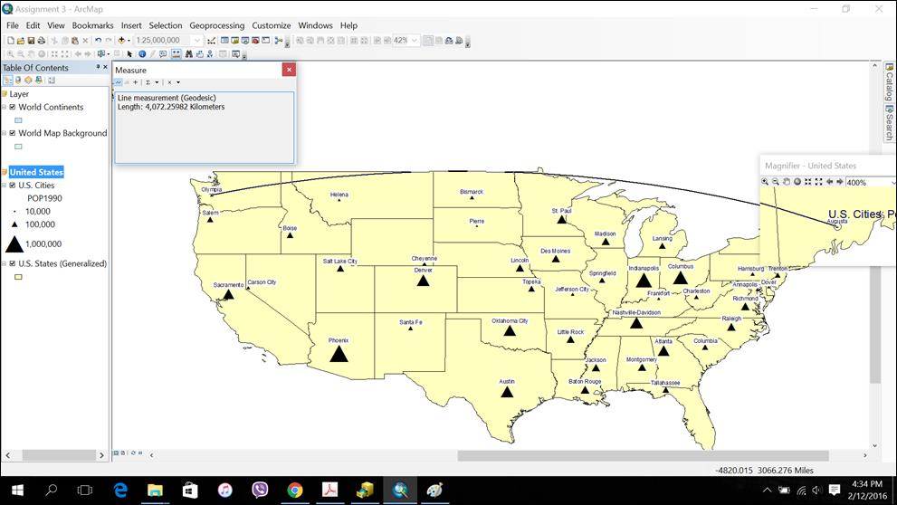
b) What is the distance between Augusta and Olympia in miles if the view is not projected?
Ans: 2530.38 miles.
c) What is the distance between Augusta and Olympia in miles if the view is projected into Albers Equal Area?
Ans: 2547.81 miles.
d) In the Cities attribute table, why do think there are several values with –99 when looking into the elevation values?
Ans: I think this is because of the change in the map projection system. Some of the values get distorted because of the change in datum level.
e) What are the same distances in kilometers?
Ans: If the views are not projected, then the distance is 4072.26 Km. If the view is projected into Albers Equal Area, then the distance is 4100.31 Km.
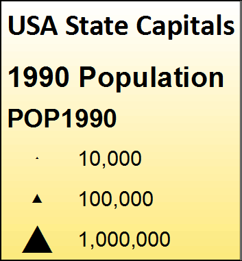
f) Which capital city is the most populous?
Ans: Phoenix, Arizona with population of 983403.
g) Which capital city is the least populous?
Montpelier, Vermont with population of 8247.
h) Which capital city has the highest elevation?
Ans: Santa Fe, New Mexico with elevation of 6989 ft.
3) Mapping New Mexico
At first, New Mexico is highlighted on the United States using select feature tool. Then, by right clicking on the states layer and choosing Data > Export Data in
the Export Data box, the map of New Mexico can be exported as a shape file and it can be added in the data frame as a separate layer. The default geodatabase was chosen as the
location of the export.
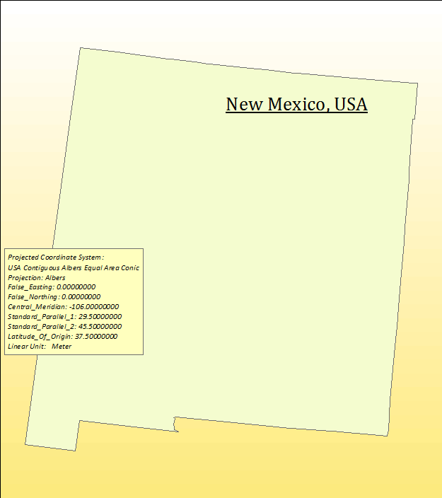
Finally, the final map layout was created with all three maps.