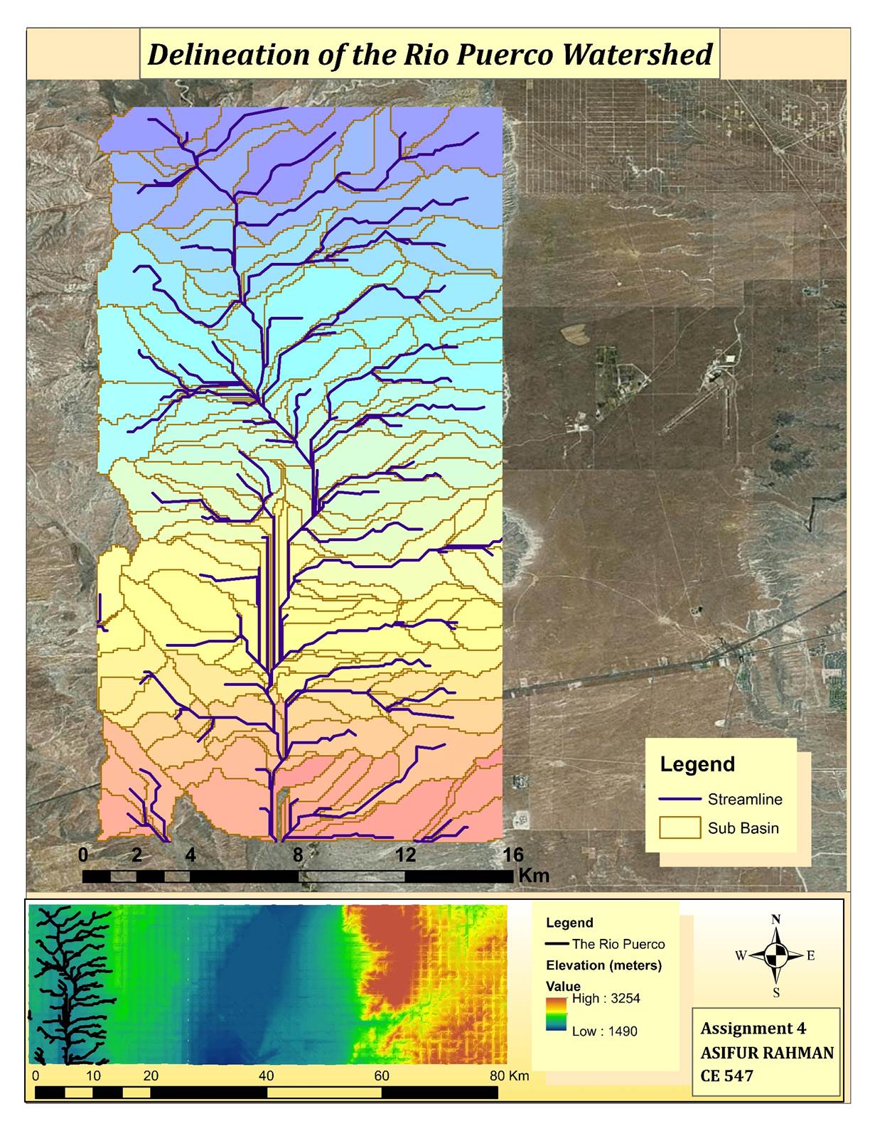
Assignment #4: Basin Delineation
At first, I imported the three ArcInfo Interchange coverage files provoded for this assignment and used the mosaic tool from the ArcToolbox to make them a continuous surface. Then I only kept the E177.E00 file and removed the other two coverages. I edited the metadata and then included a description and additional information about the file. Next I added colorized the raster using the symbology feature in the properties and added a basemap image so that I could map relative to the actual landscape as I was going.
Using the ArcToolBox Fill tool, I filed in the missing data that appeared at the joins (and any other missing data in the raster. Next, I started the hydrological part. I ran the FlowDirection tool. In class, we created only the 8 values expected from a D8 coding. When I did it at home, however, I had to change the symbology tab of the layer to “unique values” and then delete the extra values that didn’t’ match the D8 coding we are using. I then applied reversed symbology and proceeded to define the flow accumulation using the toolbox, and then zoomed in on the left side of the screen.
From this step onwards I limited processing analysis to the displayed portion of the screen. Next, I ran Stream to Feature, and defined the streams based on the fact that there are about 278 cells per square kilometer. Streams were linked next, and turned into a poly line. Outlets were defined which showed up on the polyline as dots which could be layered over the polyline. In a few cases during this process I had to re-arrange the layers so that the dots/lines/polygons format could be followed. Finally I delineated watersheds and converted the raster to polygons. I made the polygons hollow so that only the outlines showed, and the tweaked the coloration of the watershed raster and also set the transparency at 25% so that the underlying image of the watershed area could be seen.