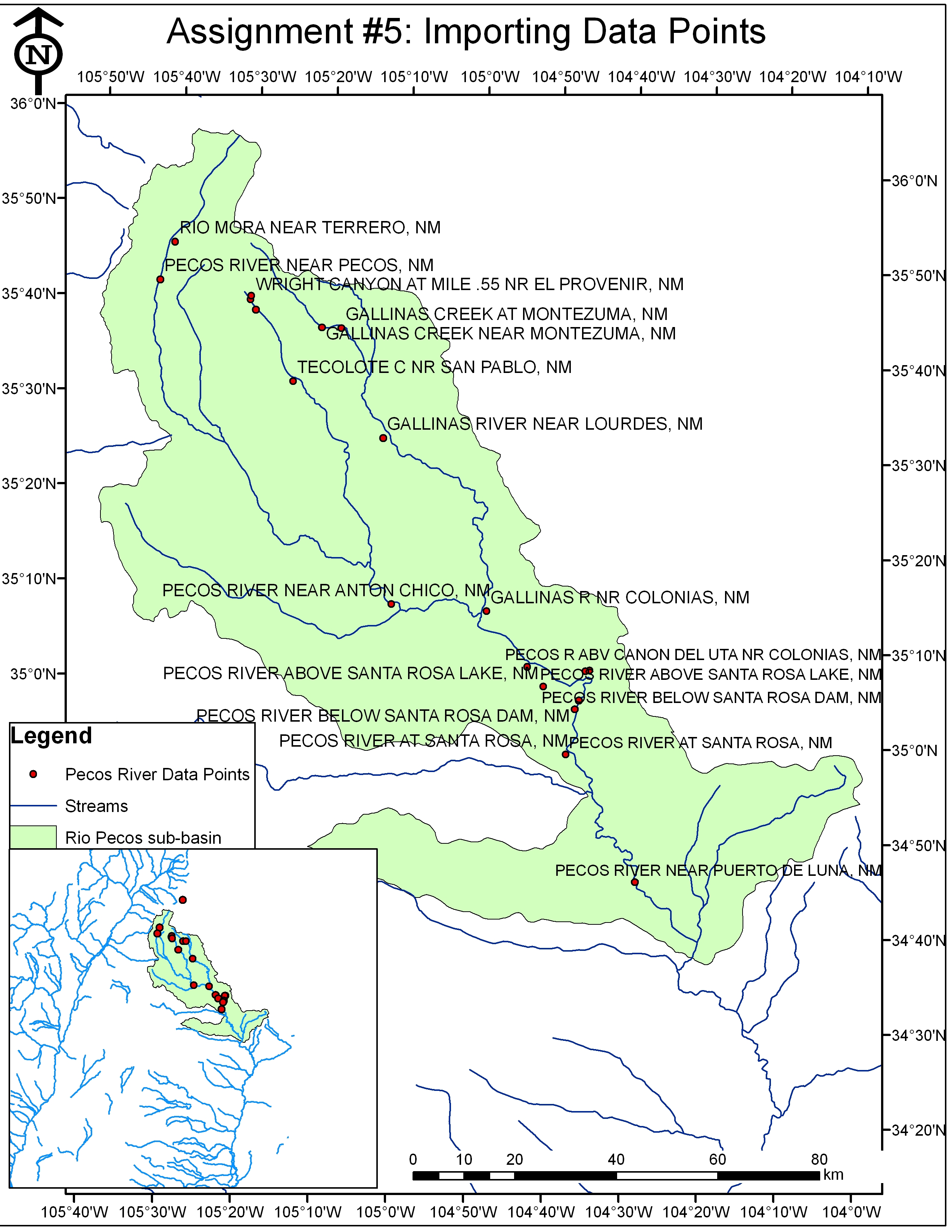
Figure 1.
Shows the headwaters of the Rio Pecos with 19 data points for latitude, longitude, and elevation taken from the
USGS waterdata website. Inset shows the Rio Pecos sub-basin within the larger regional basin.