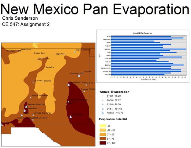
In this assignment I created a map showing pan evaporation data for various sites in New Mexico. After the data was loaded into ArcMap, I decided to add a layer detailing evaporation isopleths for the country. I wanted to see how potential evaporation compared to the pan evaporation data. As suspected, the evaporation potential matched well with the pan evaporation data.