Appendix
A. The Penman-Monteith formula and the Kimberly-Penman Equation
In 1948,
Penman described a method to calculate actual evaporation using meteorological
parameters as inputs into an energy balance equation (Penman 1948). In 1965,
Monteith described the effects of wind speed, the size and distribution of leaf
stomata, and the aerodynamic properties of plant surfaces on the rates of
transpiration from plants (Monteith 1965). Together, these studies formed the
basis of the Penman-Monteith formula, which can be expressed in mm/day as
(Monteith 1973):
ET = 0.408 * ΔRn + (105.028*(es-ea)/rs)
(Δ + 0.067*(1+(rs/ra))
Where ea is the
vapor pressure, es is the saturation vapor pressure at the current
temperature, Δ is the slope of the saturation vapor pressure (es)
curve at the given temperature, Rn is net radiation, ra
is the aerodynamic resistance to evaporation from vegetation, and rs is the physiological resistance to
transpiration from vegetation. The aerodynamic resistance, which is reciprocal
to the roughness of the earth’s surface and the wind speed, tends to be higher
over open water (110-125 s/m) than over grasslands (50-70 s/m), and the ra
over grasslands tends to be higher than that over forests (5-10 s/m) (Hendriks
2010). Surface resistance tends to be higher in forests (80-150 s/m) than in
grasslands (40-70 s/m) (Hendriks 2010). Given the wide range in aerodynamic and
surface resistance across landscapes, site specific measurements need to be
made to produce accurate ET values in a given
location. In lieu of site-specific measurements,
estimates for these values may be made based on the aforementioned ranges given
for various land cover types.
In
1982, Wright developed coefficients to apply to the Penman-Monteith equation to
measure ET in agricultural fields for various crops (Wright 1982). The field
measurements for that study were made in agricultural research fields in Kimberly,
Idaho and the equations that were developed from it are known as the
Kimberly-Penman equations. The Kimberly-Penman equation using alfalfa as a
reference crop is as follows (Wright 1982):
λETr =
(Δ/(Δ + γ))(Rn –
G) + (γ/(Δ + γ))6.43Wf(es – ea),
Where G is soil heat flux, γ is the
psychrometric constant, and Wf is the
dimensionless wind function. This is the standard equation used throughout the
US Agricultural Research Service to estimate ET at agricultural sites. This
equation is also used to calculate ET at fire weather stations, where ET is
incorporated into drought indices to measure fire danger ratings (https://raws.dri.edu/).
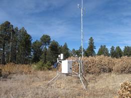
Daily ET
totals are calculated from the weather station data using the Kimberly-Penman
equation with alfalfa as a reference crop. Each weather station collects data
on air temperature, relative humidity, wind speed, and solar radiation,
averaged over 15-minute intervals, and summarized as daily averages (or daily
totals in the case of solar radiation). At the USGS stations, net radiation is
measured directly. At the RAWS stations, only incoming solar radiation is
measured, and net radiation is calculated using albedo and cloud cover values
specific to the location and time of year (Dokter
1994). At the USGS stations, the atmospheric pressure is measured directly. At
the RAWS stations, the standard atmospheric pressure estimated for the
station’s elevation is used. At Tijeras ET, the soil heat flux is measured
directly. At the other three stations, the soil heat flux is calculated using
an equation developed through soil research in Kimberly, ID (Wright 1982). The
equation is as follows:
G = 0.377(Tmean - Tpr)
where: Tmean is
the mean daily temperature in oC, Tpr is the average of the previous three days’
mean temperatures in oC, and G is
expressed in MJ/m2/day.
The
ET calculations for the RAWS stations, Oak Flats and Sandia Lakes, are
completed in the Desert Research Institute internal database. The daily ET
values were downloaded directly from the database, and then were summarized
into 8-day totals, to match the 8-day periods represented in the MODIS data.
The ET values at the USGS stations, Sandia Mountains Upper Precip
Site and Tijeras ET, were calculated by the author using an Excel spreadsheet.
The meteorological data was summarized into daily averages, or daily totals in
the case of net radiation and soil heat flux, and the appropriate calculations
were made to derive 8-day evapotranspiration totals.