Results
The
first 8-day period that was analyzed was February 10-17, 2014. After nullifying
and filling in erroneous data in the MODIS images, there will still large gaps
in the grid, the largest of which was over the city of Albuquerque (Figure 2).
The ET values derived from the weather station data ranged from 8.39 kg/m2/8-days
at Sandia Mountains to 19.71 kg/m2/8-days at Sandia Lakes (Table 2,
Figure 3). The percent that the MODIS data deviated from the weather station
data ranged from 98% in a few scattered cells to 500% at Sandia Mountains Upper
Precip Site (Figure 4). The rest of the results are
summarized in Table 2 and the figures below.
Table 2. Evapotranspiration values
(kg/m2/8-days) for Bernalillo County, NM weather stations
|
8-day Period |
Sandia Mountains |
Tijeras ET |
Oak Flats |
Sandia Lakes |
|
2/10/2014 –2/17/2014 |
8.39 |
17.92 |
20.4 |
19.71 |
|
2/18/2014 – 2/25/2014 |
11.38 |
20.30 |
21.29 |
21.78 |
|
2/26/2014 – 3/5/2014 |
6.13 |
14.92 |
15.06 |
19.07 |
|
3/6/2014 – 3/13/2014 |
9.54 |
20.76 |
19.2 |
19.81 |
|
3/22/2014 – 3/29/2014 |
15.09 |
26.65 |
22.13 |
24.77 |
|
3/30/2014 – 4/6/2014 |
17.51 |
30.80 |
23.89 |
27.97 |
|
4/7/2014 – 4/14/2014 |
32.18 |
32.82 |
27.97 |
27.85 |
|
4/15/2014 - 4/22/2014 |
28.98 |
31.54 |
24.1 |
25.08 |
|
4/23/2014 – 4/30/2014 |
24.80 |
36.62 |
24.58 |
27.82 |
Figure 4. Percent difference that ET
values derived from MODIS data deviated from ET values derived from weather
station data, 2/10/2014 – 2/17/2014
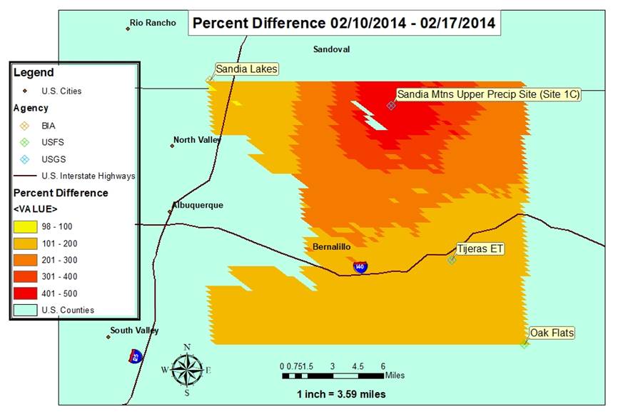
Figure 5. Percent difference that ET
values derived from MODIS data deviated from ET values derived from weather
station data, 2/18/2014 – 2/25/2014
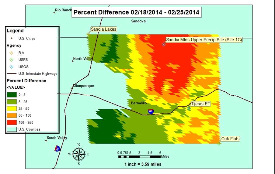
Figure 6. Percent difference that ET
values derived from MODIS data deviated from ET values derived from weather
station data, 2/26/2014 – 3/5/2014
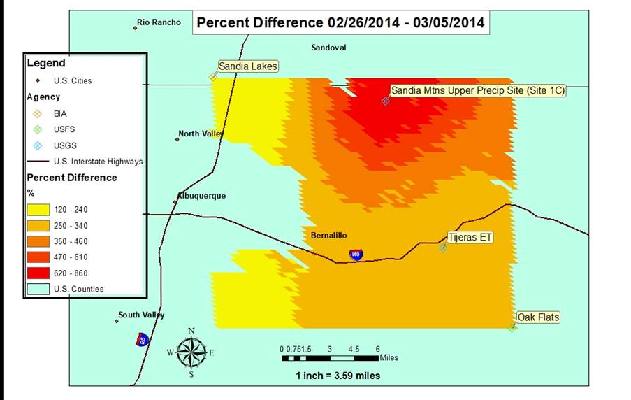
Figure 7. Percent difference that ET
values derived from MODIS data deviated from ET values derived from weather
station data, 3/6/2014– 3/13/2014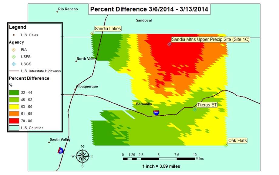
Figure 8. Percent difference that ET
values derived from MODIS data deviated from ET values derived from weather
station data, 3/22/2014 – 3/29/2014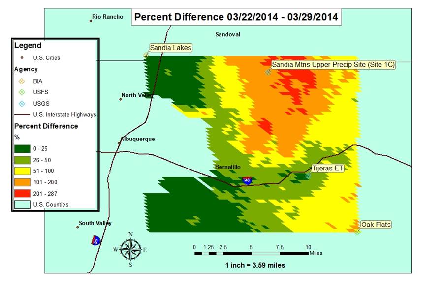
Figure 9. Percent difference that ET
values derived from MODIS data deviated from ET values derived from weather
station data, 3/30/2014 – 4/6/2014
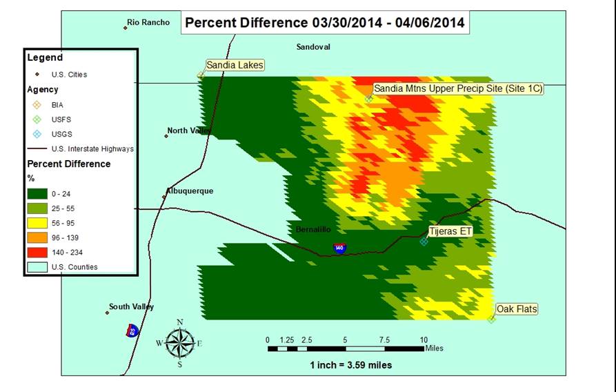
Figure 10. Percent difference that ET
values derived from MODIS data deviated from ET values derived from weather
station data, 4/7/2014 – 4/14/2014
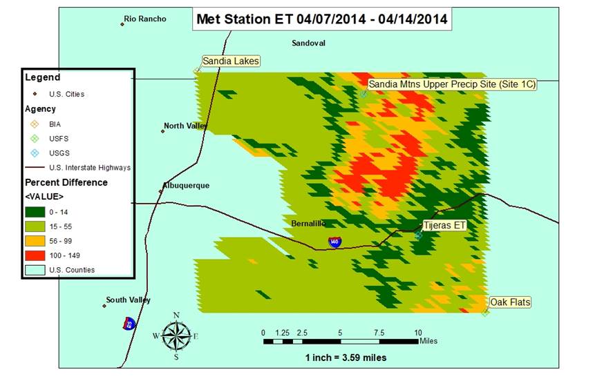
Figure 11. Percent difference that ET
values derived from MODIS data deviated from ET values derived from weather
station data, 4/15/2014 – 4/22/2014
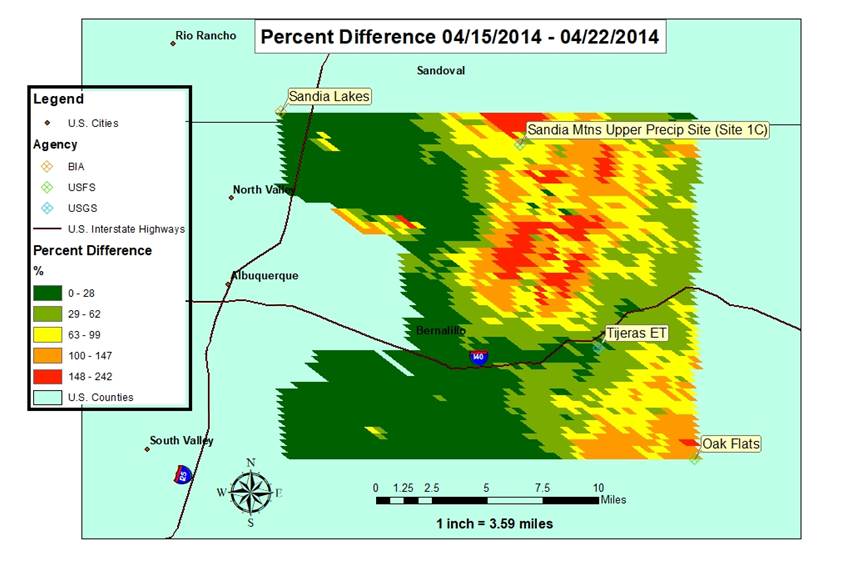
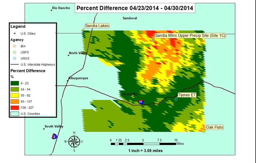
Figure 12. Percent difference that ET
values derived from MODIS data deviated from ET values derived from weather
station data, 4/23/2014 – 4/30/2014