Homework 4
The map created for assignment 4
shows a portion of the
Rio Puerco watershed with subbasin boundaries and streams
delineated based on elevation data in ArcGIS.
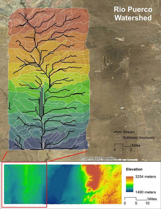
Homework 4
The map created for assignment 4
shows a portion of the
Rio Puerco watershed with subbasin boundaries and streams
delineated based on elevation data in ArcGIS.