Homework 5
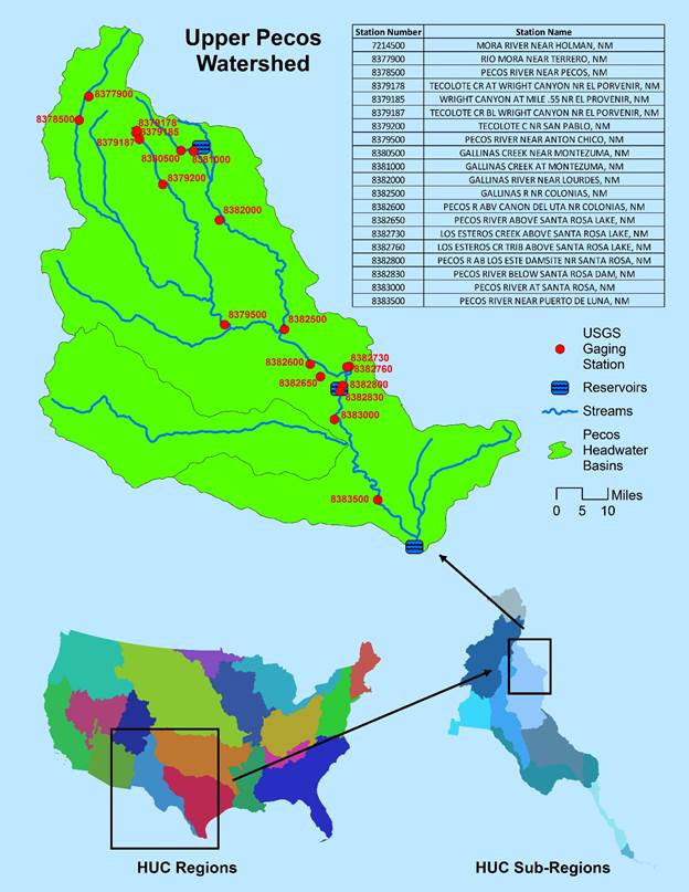
Two maps were created as part of
assignment 5: A map of the upper Pecos watershed with USGS gaging stations
(top),
and a map of mean annual discharge data for three selected years (bottom).
Homework 5
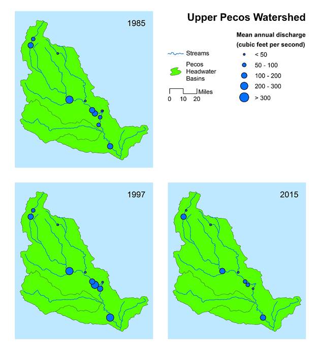
Two maps were created as part of
assignment 5: A map of the upper Pecos watershed with USGS gaging stations
(top),
and a map of mean annual discharge data for three selected years (bottom).