Ian Latella
CE547
Assignment #3
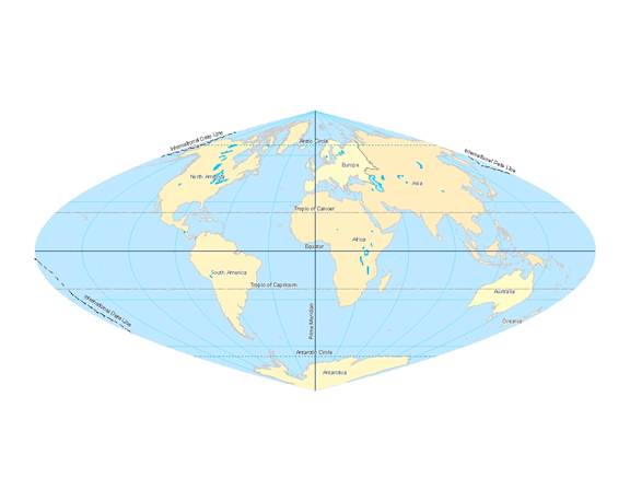
I projected the World with the World Craster Parabolic Projection. A Craster parabolic projection is a pseudocylindrical projection that is often used to produce thematic maps of the world. This type of projection also works well for producing interrupted maps, such as the parallel and sinusoidal interrupted Craster projections. The central meridian lies at 36o 46’ north and south and the projection is free of distortion there. As you get farther and farther from the central meridian, distortion increases and is greatest at the outer meridians and high latitudes.
World_Craster_Parabolic
Projection: Craster_Parabolic
False_Easting: 0.000000
False_Northing: 0.000000
Central_Meridian: 0.000000
Linear Unit: Meter
GCS_WGS_1984
Datum: D_WGS_1984
The distance between
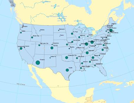
The approximate latitude and longitude of three capitol cities are in the table below.
|
City |
Latitude |
Longitude |
|
|
-105.222 |
39.846 |
|
|
-121.554 |
38.75 |
|
|
-93.513 |
41.708 |
The most populous capitol city in the
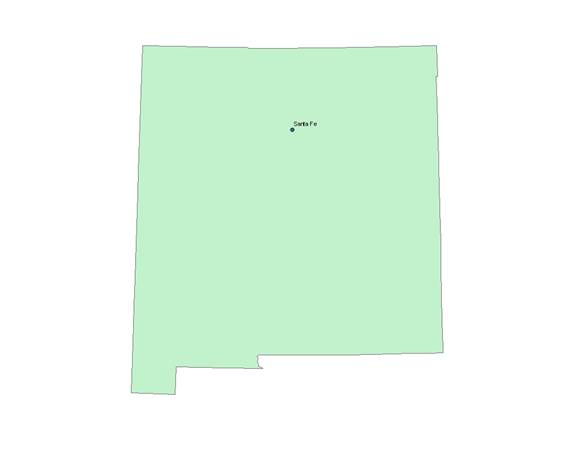
The layer that I chose did not have elevational
data so I chose to look at the capitol with the largest land area which was
USA_Contiguous_Albers_Equal_Area_Conic
Projection: Albers
False_Easting: 0.000000
False_Northing: 0.000000
Central_Meridian: -106.000000
Standard_Parallel_1: 29.500000
Standard_Parallel_2: 45.500000
Latitude_Of_Origin: 37.500000
Linear Unit: Meter
GCS_North_American_1983
Datum: D_North_American_1983