Miguel Santistevan
CE 547
Assignment #4
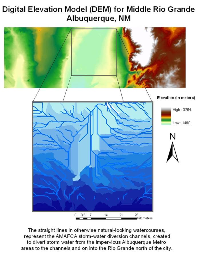
This assignment was an exercise in downloading three digital elevation coverages from the internet, using the ‘raster calculator’ to join them together, and fixing areas of blank and anomalous data. A Digital Elevation Model (DEM) for an area from the east side of the Sandia mountains to the Rio Puerco watershed in the west, including Albuquerque, Rio Rancho, and surrounding areas, was created for spatial analysis in showing water courses in this middle Rio Grande basin. Raster calculations were performed based on flow direction and flow accumulation GRID data to determine the locations of watercourses. This data had to be run through a series of calculations to show connections to adjoining sources of flow, determine the sizes of areas required to qualify for likely presence of flow, and determine the boundaries of watershed sub-basins based on the direction of flow and slope. The areas in the city served by the drainage structures known as the AMAFCA (Albuquerque Metropolitain Area Flood Control Authority) channels represent an area of interest for future analysis.