Homework #3
In this hw we learn different type of projection and their feature
and usage:
Part1:
The following projection is North_Pole_Gnomonic:
 This is kind of Planar projection (azimuthal
projection), in this projection the great circles are related to straight
lines the meridians are shown by centric lines. The main feature of this
projection in direction, which is accurate from the center, so this is mainly used
for routes of navigation sea and air. This projection is limited by its
perspective point and cannot project a line that is 90° or more from the center
point; this means that the equatorial aspect cannot project the poles, and the
polar aspects cannot project the equator. A radius of 30° produces moderate
distortion, as indicated in the table above. This projection should not be used
more than about 60° from the center.
This is kind of Planar projection (azimuthal
projection), in this projection the great circles are related to straight
lines the meridians are shown by centric lines. The main feature of this
projection in direction, which is accurate from the center, so this is mainly used
for routes of navigation sea and air. This projection is limited by its
perspective point and cannot project a line that is 90° or more from the center
point; this means that the equatorial aspect cannot project the poles, and the
polar aspects cannot project the equator. A radius of 30° produces moderate
distortion, as indicated in the table above. This projection should not be used
more than about 60° from the center.
Part 2:
In this part we learn how to use the Query tab (in layer properties). And we can provide a specific definition by Python to see the data with specific features.
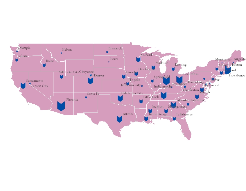
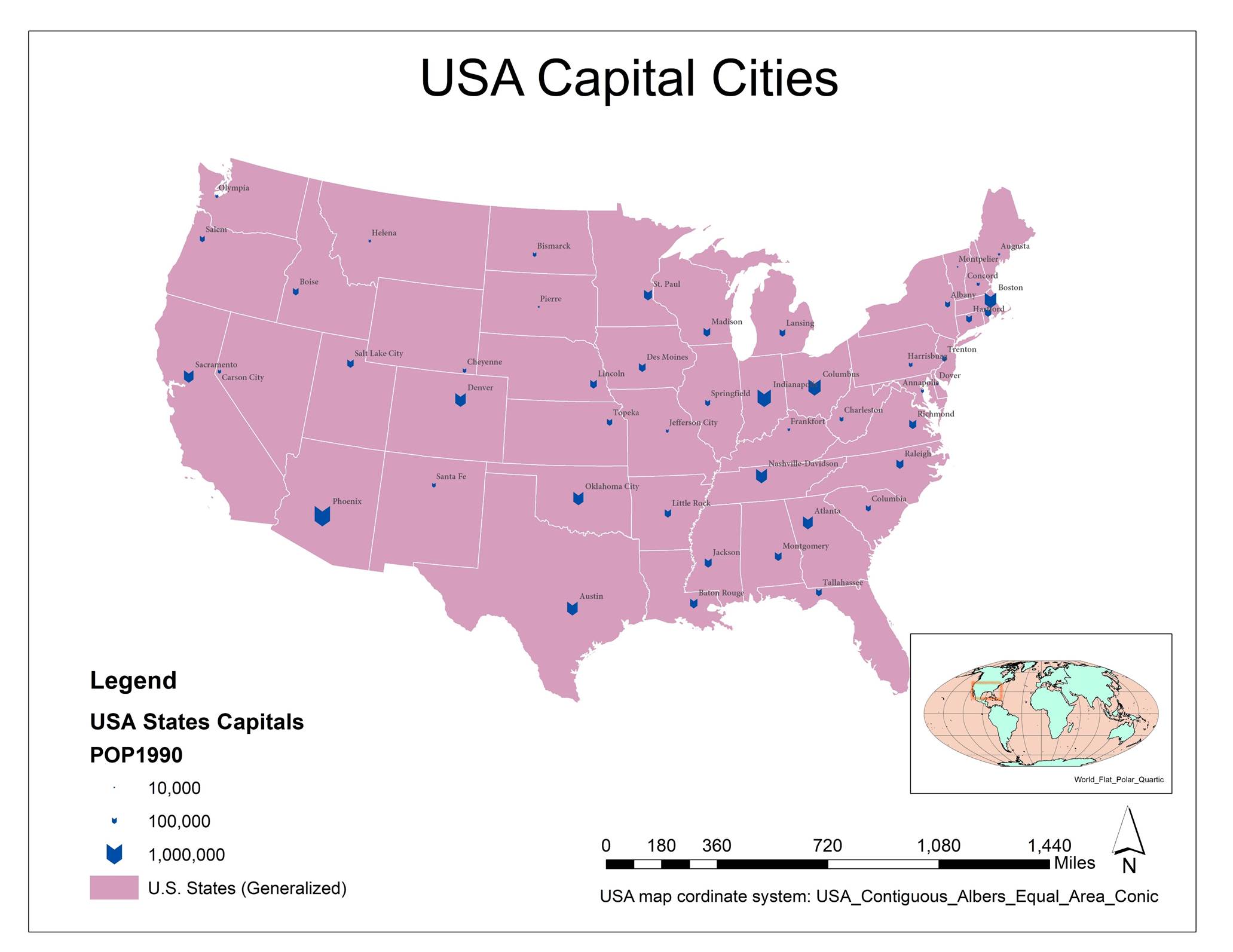
Display layer based on population and label the cities.
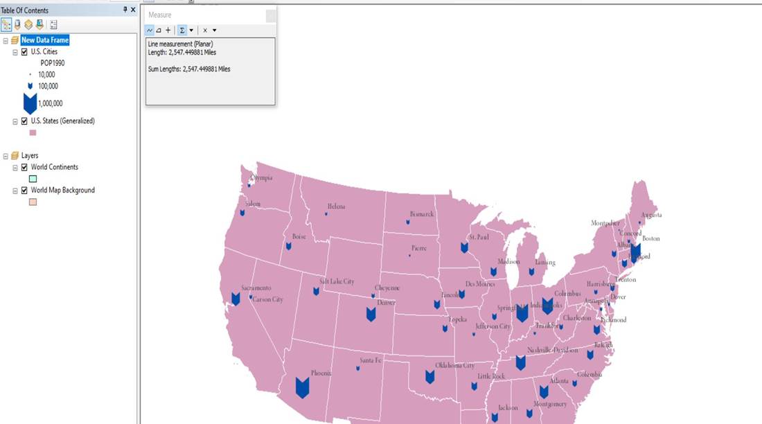
Measure distance:
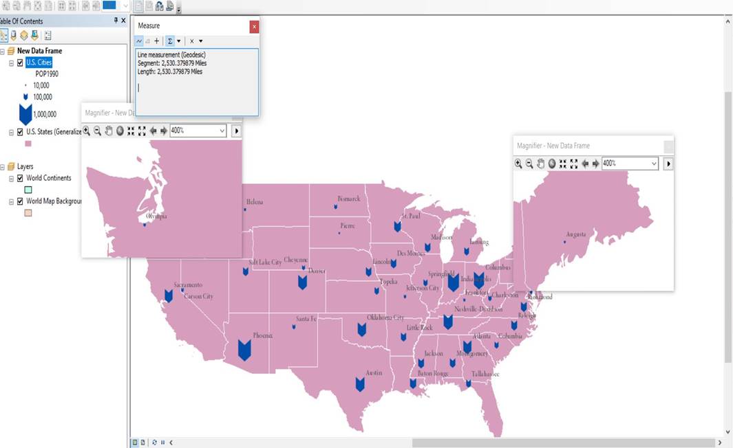
.
Change display units:
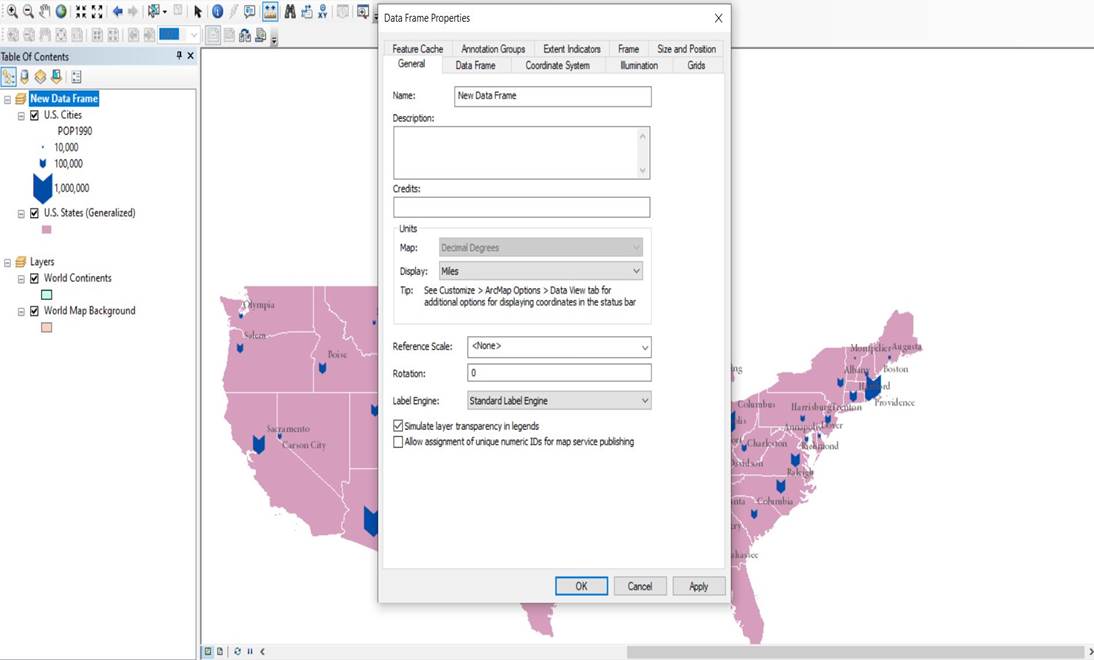
Change projection:
Finding more details:
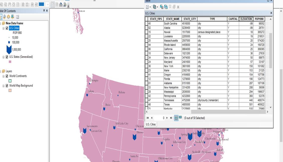 elevation
means the height of cities according to the reference (sea level)
elevation
means the height of cities according to the reference (sea level)
-99 is the height in compare to see level. Which means they are -99 unites under the sea levels.
.
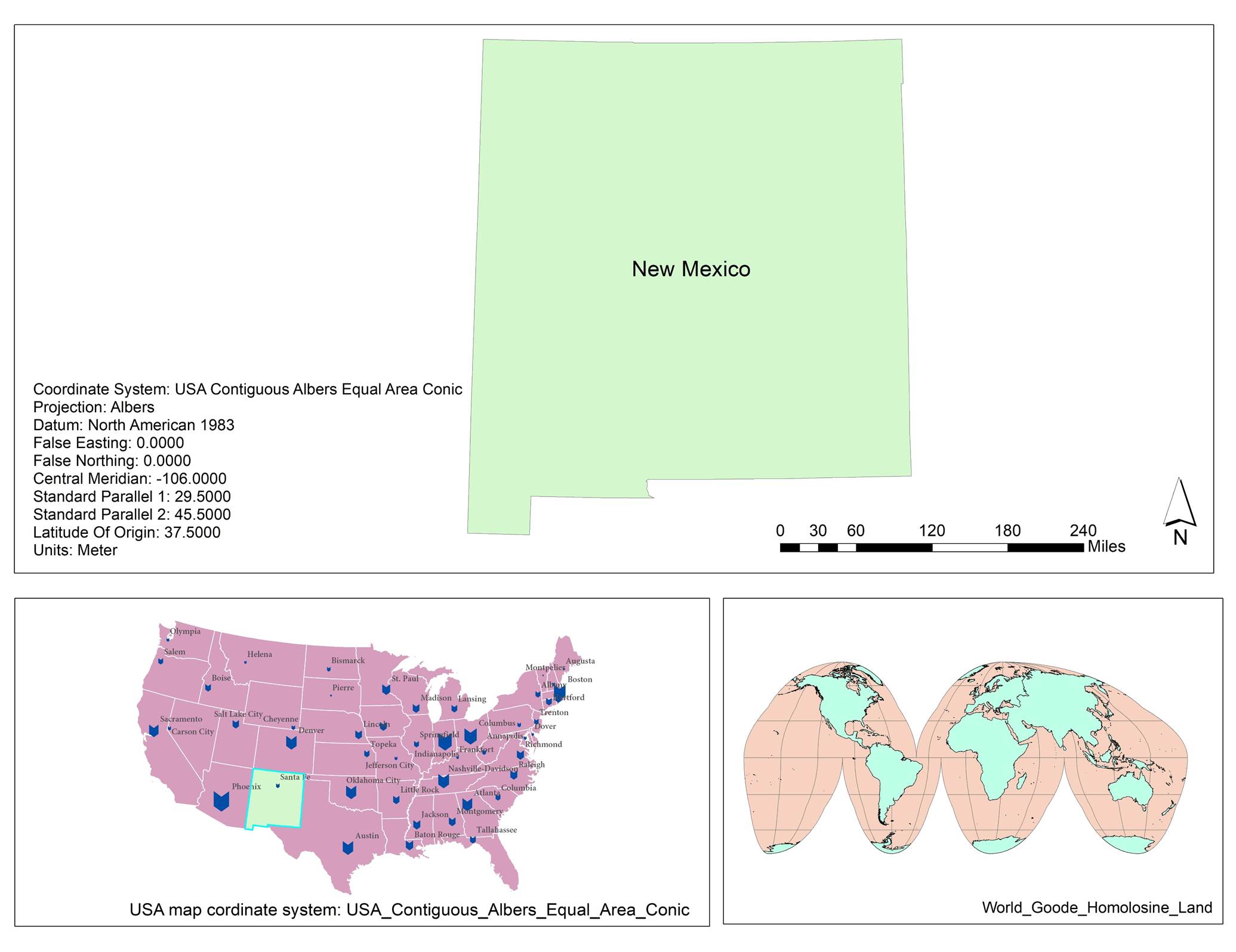
Create your “USA map” layout:
Part 3: Mapping NM
1. Select NM > right click on data frame > data> export > make NM
2. Use Arctoolbox > data management > projection and transformation > project > input = NM > out put > choose projection coordinate system