Assignment
6
The first aspects of this
assignment narrows the immense amount of data down to just the soils
within the Pecos Watershed. I than had
to join and relate tables in order to make the data make sense.
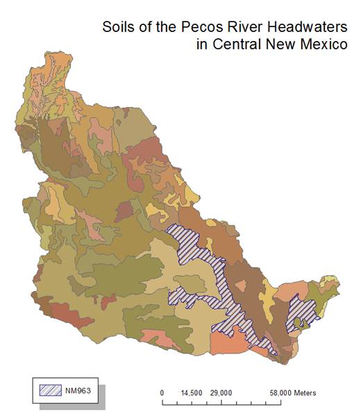
1) According
to the mapunit and component tables the properties
for NM963 are
2) It
is made up of 8 components
3) Those
8 components are; Reggnier, Latom,
Rock outcrop, Los Tanos, Regnier,
Latom, Regner and Gallen.
4) The percentages of the map unit for each are ;
Reggnier 27%, Latom 27%,
Rock outcrop18%, Los Tanos12%, Regnier7%, Latom5%, Regner2% and Gallen2%.
5) The
Predominant surface slope is
about 20%.
6) The
dominant soil texture is fine sandy loam.
7) Soil
group A is 0%.
Soil group B is 2%.
Soil group C is 12%
Soil group D is 82%
8) These soil properties would make sense where
they are located.
By relating the layer and comp tables and
eliminating the fields not focused on we are able to conclude the following;
|
Component |
Number of layers |
Soil
Depth (in) |
Water
Holding Capacity (in) |
|
1 |
3 |
22 |
3.06 |
|
2 |
2 |
20 |
1 |
|
3 |
1 |
60 |
0 |
|
4 |
3 |
28 |
3.3 |
|
5 |
3 |
22 |
3.06 |
|
6 |
2 |
20 |
1 |
|
7 |
3 |
22 |
2.43 |
|
8 |
4 |
60 |
3.52 |
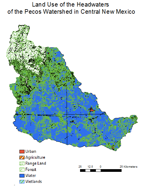
By importing data from the rgis site I was able to
create an image that shows land use in the watershed being studied.