Results and Conclusions
Overall the different
figures obtained from the groundwater elevation analysis showed that this
resource is readily available in the area, with no big temporal changes. Figure
2A shows the groundwater elevation contours for the spring and the summer of
2003, 2008 and 2011. Figure 2B displays the groundwater elevation contours for
fall and winter of 2003-2005, 2007-2008 and 2010-2011.
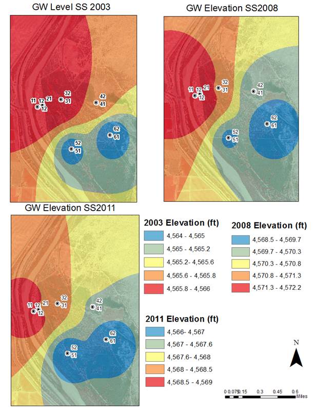
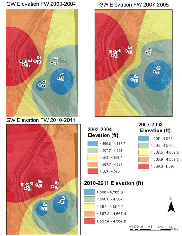
Figure 2. (A)
Temporal variations of groundwater elevations for spring and summer. (B) Temporal
variations of groundwater elevations for fall and winter
The
groundwater quality data shows that the main anions are Sulphate
and Bicarbonate while the main cations are Calcium and Sodium (Figure 3).
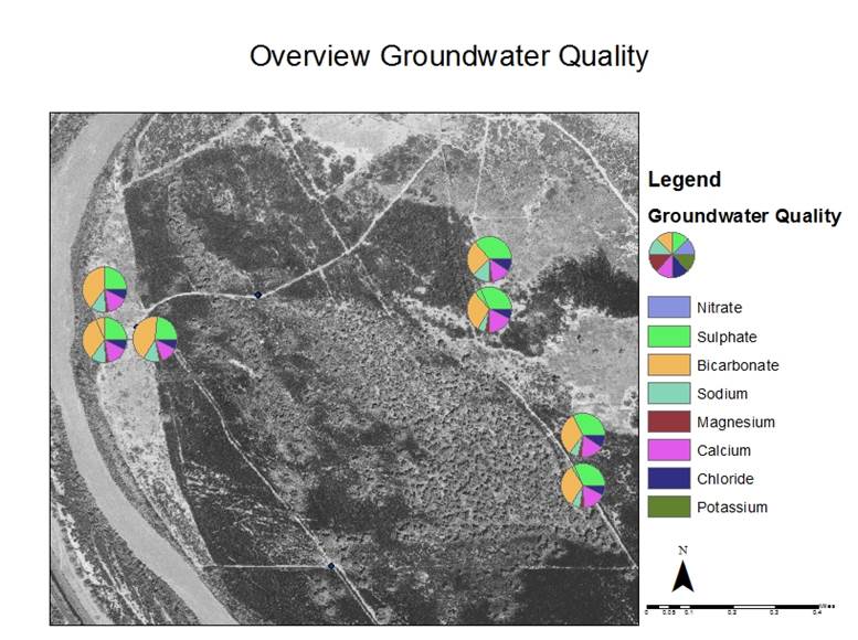
Figure 4.
Overview of the groundwater quality on the Rhodes property
Finally,
Figure 4 shows the proposed vegetation plan and based on the “Landscape Plant
Lists for Salt Tolerance Assessment” published by Texas Agricultural Experiment
Station (See Appendix on the Final Project link) it can be concluded that the
chloride concentration in the groundwater is not harmful for any of the
proposed species of plants and shrubs, therefore these could potentially grow
anywhere around the property (Figure 5).
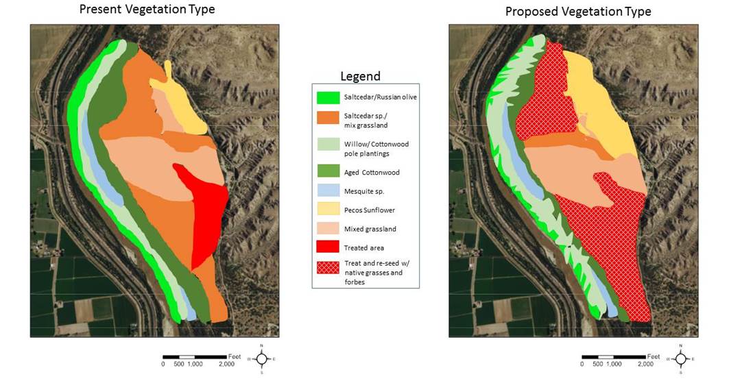
Figure 4. Current vegetation
vs proposed restoration approach
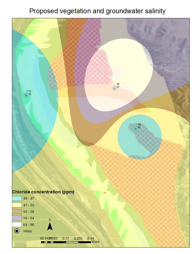
Figure
5. Overlay of groundwater salinity with proposed vegetation
Conclusion
The
groundwater and the surface water are very well connected in this reach. The
water quality meets all the public standards for drinking water supply with no
treatment and is suitable for growing the proposed plants and shrubs for our
restoration project. Finally GIS is a very useful tool for analyzing
groundwater, in the future it would be interesting to directly model surface
water influences in groundwater recharge and long term effects of
evapotranspiration due to the change in vegetation.