CE 547 – GIS in
Water Resources Engineering University of New
Mexico – Spring 2016 Vanessa Garayburu
Assignment 3: Projections
a) Mapping the world
For this exercise we were asked to project the world using different
projections and to choose one. I chose the Winkel Tripel projection, because it had a common visual
representation of the world. This projection became popular after 1998 when the
National Geographic adopted it as the standard world projection.
Projection method
According to the ArcGIS help, the projection method is based on modified
azimuthal, where the coordinates are the average of the Aitoff
and equirectangular projections. Meridians are
equally spaced and concave toward the central meridian. The central meridian is
a straight line. Parallels are equally spaced curves, concave toward the poles.
The poles are approximately 0.4 times the length of the equator. The length of
the poles depends on the standard parallel chosen.
Projection
parameters
Projection: Winkel_Tripel
False_Easting: 0.0
False_Northing: 0.0
Central_Meridian: 0.0
Standard_Parallel_1: 50.467
Linear Unit: Meter (1.0)
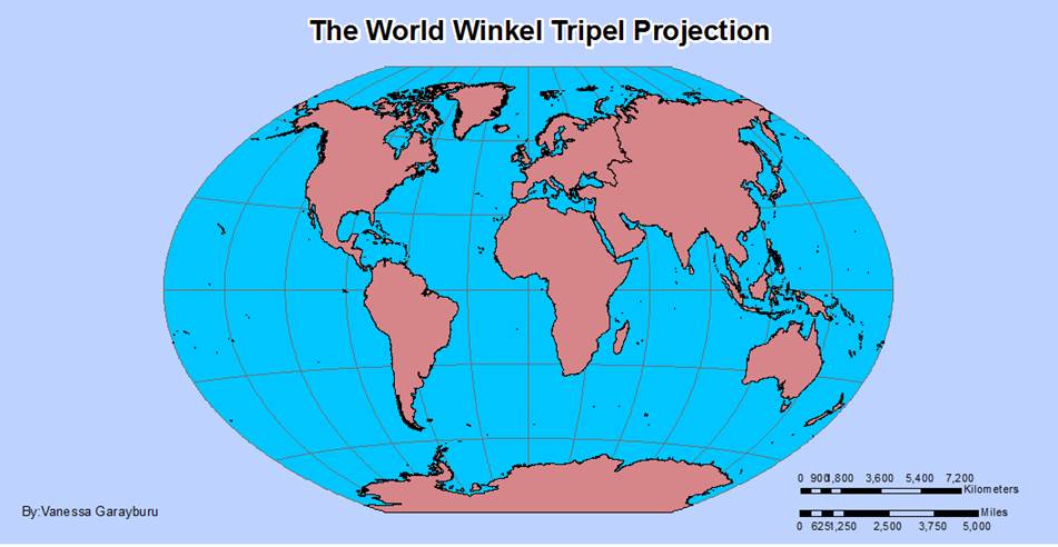
Figure 1. Shows the World Map on Winkel
Tripel Projection
b) Mapping the United
States
This exercise consisted in organizing, categorizing and
displaying U.S. cities based on population in 1990. Practicing calculating
distances using the projected and the non-projected version of the map as well
as answering some key questions related to population and elevation. In the
table of attributes, the -99 values for elevation belong to a code that represents
missing data.
i.
Determine the approximate latitude and
longitude of three cities
· Baton Rouge, LA:
-91.123, 30.447 Decimal Degrees
· Madison, WI : -89.51,
43.083 Decimal Degrees
· Frankfort, KY : -84.853,
38.278 Decimal Degrees
ii.
What is the distance between Augusta and
Olympia in miles if the view is not projected?
2,530.4 miles
iii.
What is the distance between Augusta and
Olympia in miles if the view is projected into Albers Equal Area?
2,547.8 miles
iv.
What are the same distances in
kilometers?
Not projected 4,072.3 km and Albers Equal Area is 4,100.3 km
v.
Which capital city is the most populous?
Phoenix, AZ with 983,403 people
vi.
Which capital city is the least
populous?
Montpelier, VT with 8,247 people
vii.
Which capital city has the highest
elevation?
Santa Fe, NM at 6989 feet above sea level
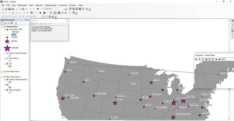
Figure 2. Illustrates how to measure the distance between two
cities in ArcGIS
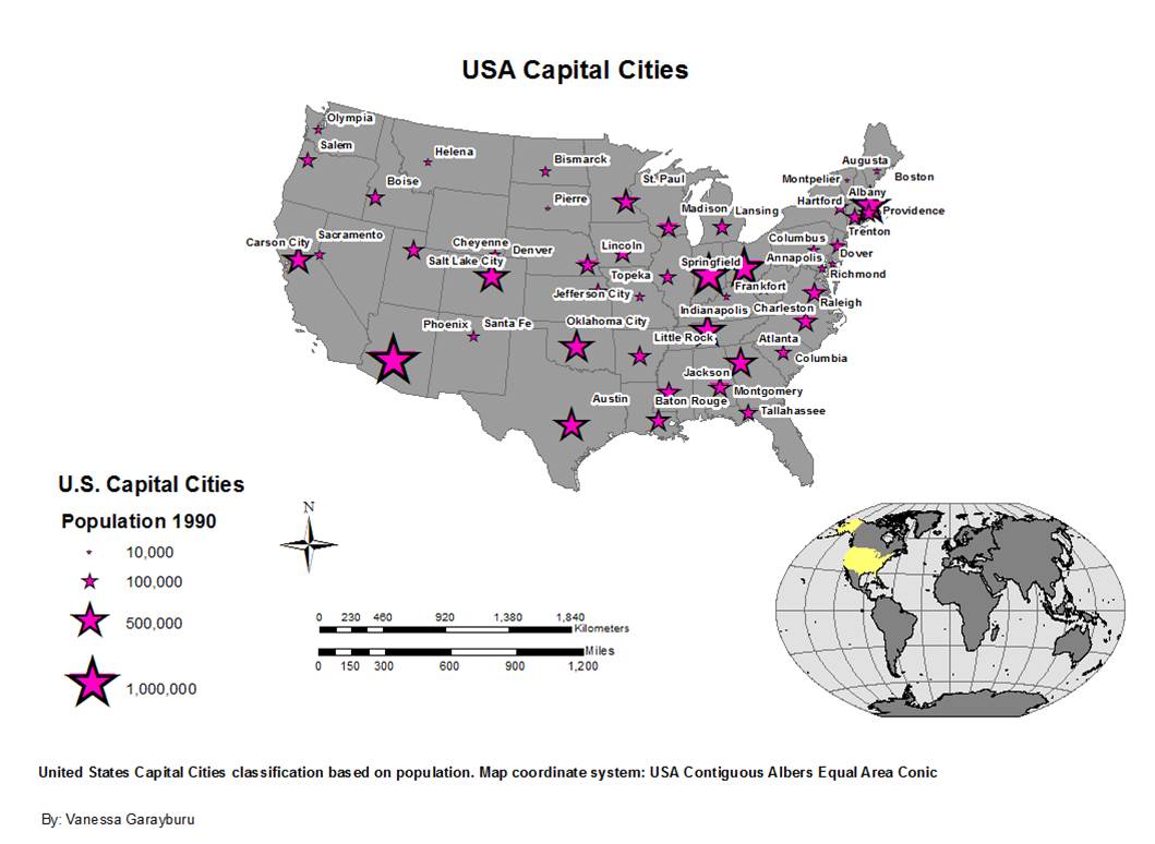
Figure 3. Represents contiguous U.S. capitals cities arranged
by 1990 population projected on Albers Equal Area Conic
Projection method
Conic. The meridians are
equally spaced straight lines converging to a common point. Poles are
represented as arcs rather than as single points. Parallels are unequally
spaced concentric circles whose spacing decreases toward the poles.
Projection
parameters
Projection: Albers
False_Easting: 0.0
False_Northing: 0.0
Central_Meridian: -96.0
Standard_Parallel_1: 29.5
Standard_Parallel_2: 45.5
Latitude_Of_Origin: 37.5
Linear Unit: Meter (1.0)
c) Mapping New Mexico
This exercise consisted on extracting NM from the U.S. map as a shape
file and exporting it to Albers projection. Then re-introducing it in a new
data frame and changing its central meridian to -106.
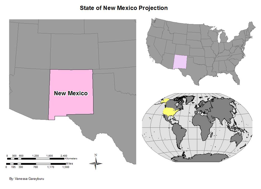
Figure 4. Shows the state of New Mexico projected on Albers
Equal Area Conic
Projection
parameters
Projection: Albers
False_Easting: 0.0
False_Northing: 0.0
Central_Meridian: -106.0
Standard_Parallel_1: 29.5
Standard_Parallel_2: 45.5
Latitude_Of_Origin: 37.5
Linear Unit: Meter (1.0)