GIS UNM CE547 Spring 2006
Assignment 4
In the first frame, we import an interchange file of a Digital Elevation Model of the
Albuquerque area. Using the arcgis "flowdirection", "flowaccumulation",
and "streamlink" GRID functions, we construct a stream network. The
elevation is keyed in false color.
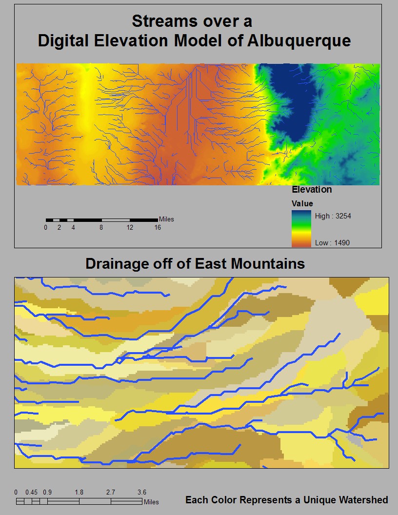
In the second frame, we have zoomed in on a region of the East
Mountains. Using the "zonalmax", "con", and "watershed" functions, we
dispay unique watersheds overlain with previously calculated stream
network.