|
Inundation of habitat restoration features in the South Diversion Channel sub-reach of the Rio Grande, New Mexico |
Introduction
Under NMISC Project RG-22, “Middle Rio Grande Riverine Habitat
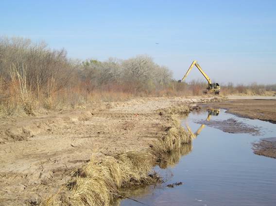
Restoration: Phase 1,” construction took place between February 24 and March
27, 2006, to create 6 habitat features in the South Diversion Channel (SDC)
sub-reach of the Albuquerque Reach of the Rio Grande, New Mexico. 3 bank
features below the SDC confluence with the Rio Grande were constructed by
cutting and moving soil material to lower the river banks.
|
|
|
|
|
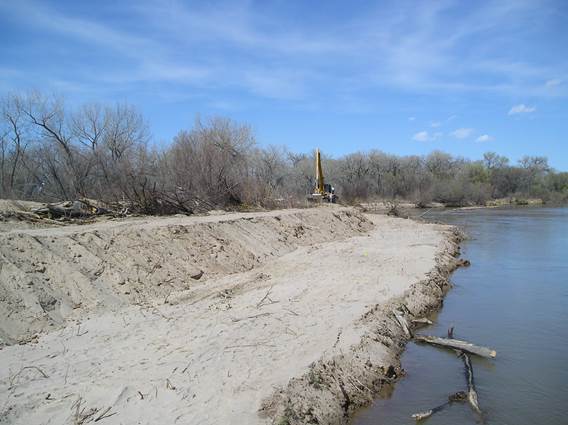
Construction
of Bank #1 (2) |
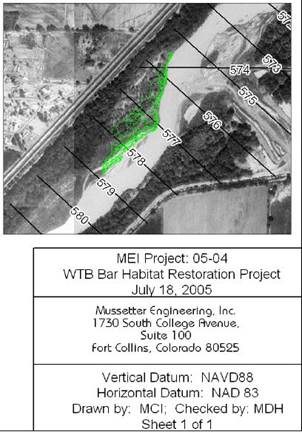
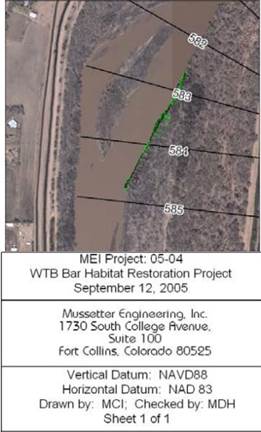
Elevation
contours of Bank #1 (3) |
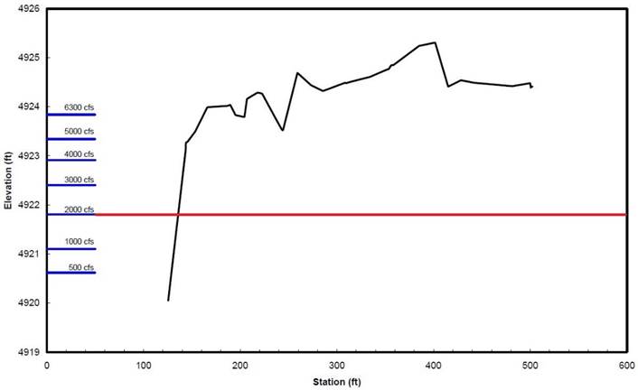
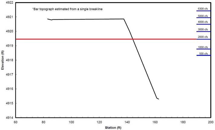
Cross-section
of Bank #1 (3) |
|
|
|
|
|
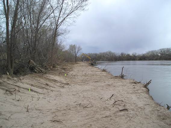
Construction
of Bank #2 (2) |
Elevation
contours of Bank #2 (3) |
Cross-section
of Bank #2 (3) |
|
|
|
|
|
Construction
of Bank #3 (2) |
Elevation
contours of Bank #3 (3) |
Cross-section
of Bank #3 (3) |
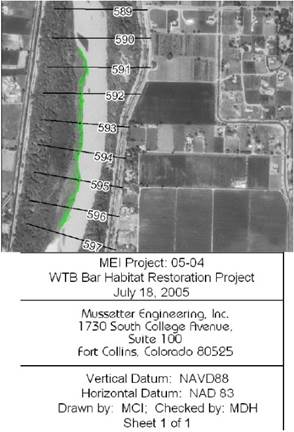
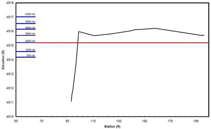
Pre-construction surveys in 2005 created elevation contours and
cross-section profiles for all potential sites for restoration, including bank
features.
Objective
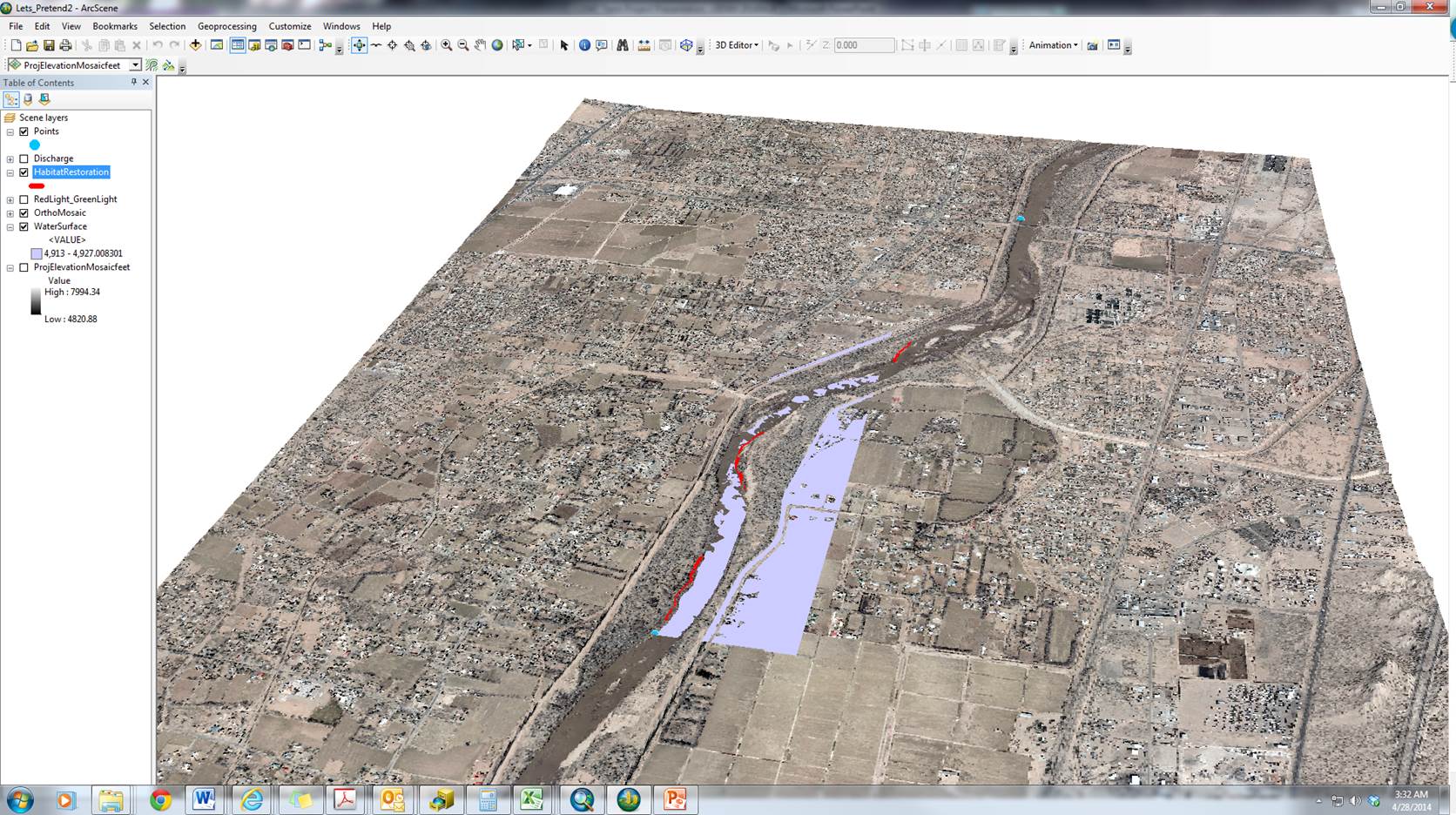
Looking at gages upstream and downstream of constructed bankline features, this study sought to visualize, in ArcScene 10.1 (1), the interaction between the water
surface, interpolated from gage height, riparian areas, and associated bankline habitat restoration features.
Data
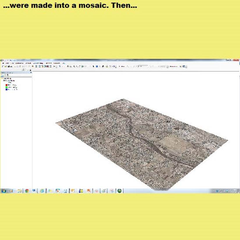
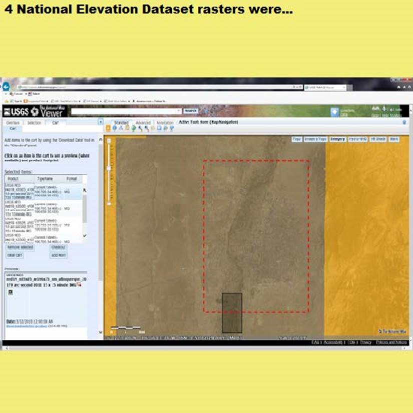
Two sets of data were needed to create a 3-dimenional view of the
landscape in the South Diversion Channel subreach.
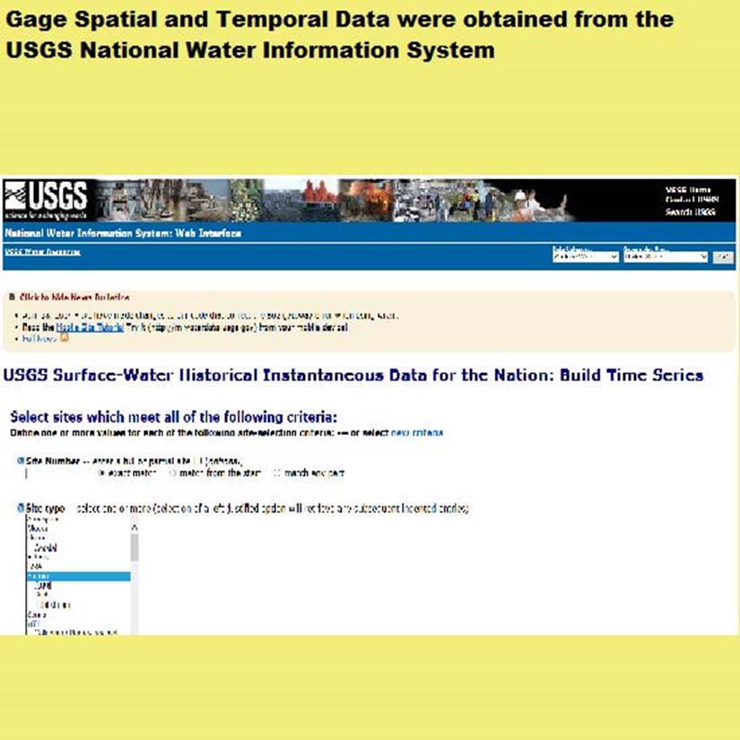
Gage spatial and temporal data were obtained using the same process as Assignment
#5.
Data Processing
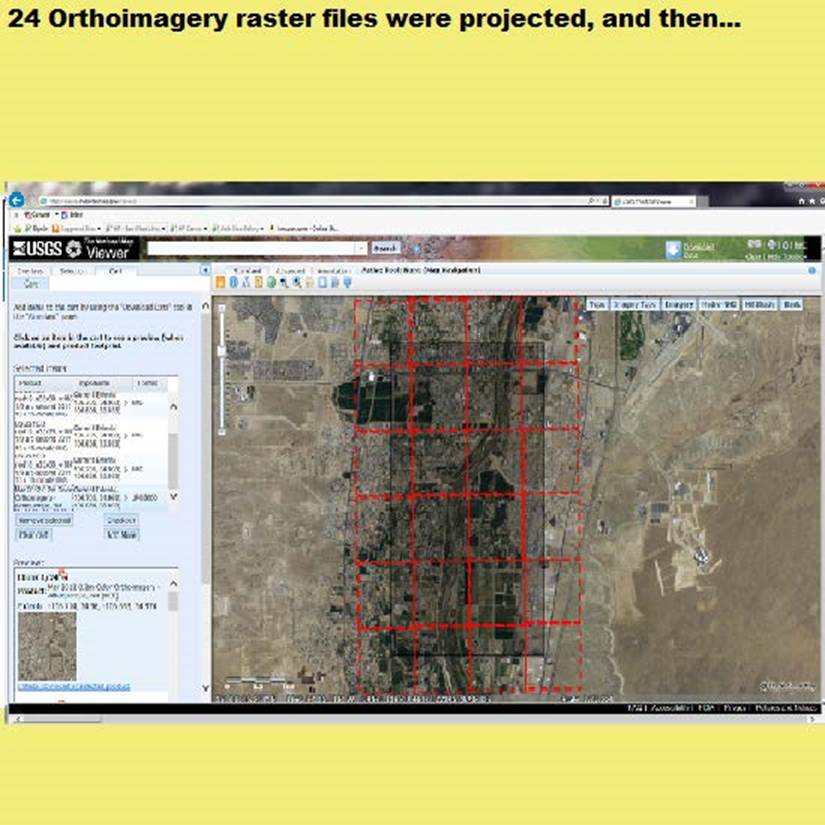
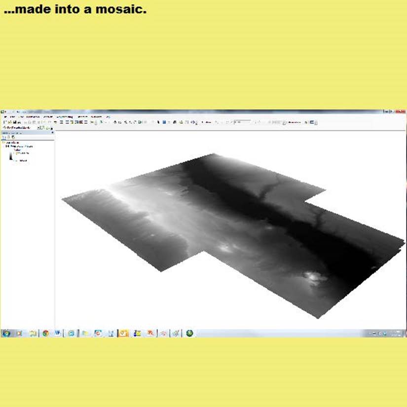
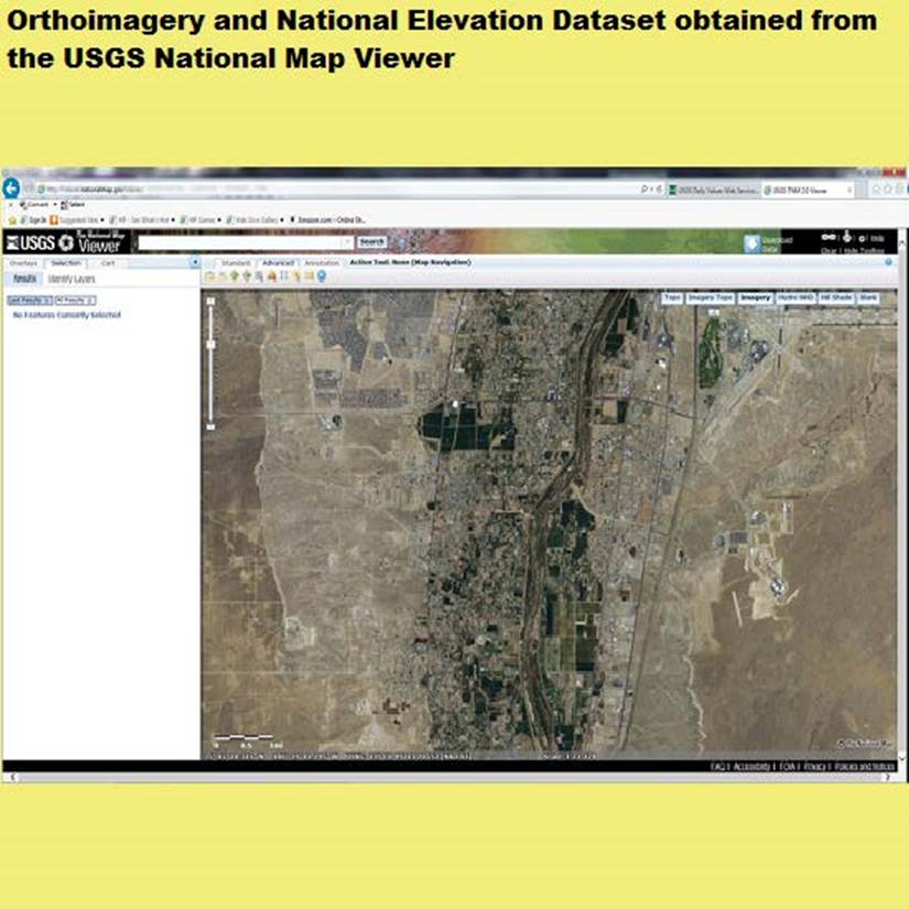
Laying the orthoimagery on the elevation
raster allowed the imagery to be viewed as a 3-dimensional surface. For
simplicity, the gage locations and gage height data were related for a single
date, April 20, 2009. A surface representing the water surface was created
using Natural Neighbor interpolation.
Result
Discussion
References
(1) Esri, 2012. ArcScene 10.1 [computer software], Redlands: Esri.
(2) SWCA Environmental Consultants (SWCA), 2006. Summary of Construction Activities at the
South Diversion Channel Subreach, Albuquerque, NM: Prepared for the New
Mexico Interstate Stream Commission.
(3) SWCA & Mussetter Engineering, Inc. (MEI), 2006. Initial Island and Bar Geomorphic Surveys
for the Rivering Habitat Restoration Project in the Albuquerque Reach, Middle
Rio Grande, New Mexico, Albuquerque, NM: Prepared for the New Mexico
Interstate Stream Commission.
(4)
U.S. Geological Survey (USGS), 2014. The National Map Viewer, DOI: Map services
and data available from U.S. Geological Survey, National Geospatial Program.
(5) U.S. Geological Survey (USGS), 2014. USGS Surface-Water Daily
Data for the Nation, DOI: Surface-water and groundwater data and statistics
available from U.S. Geological Survey.