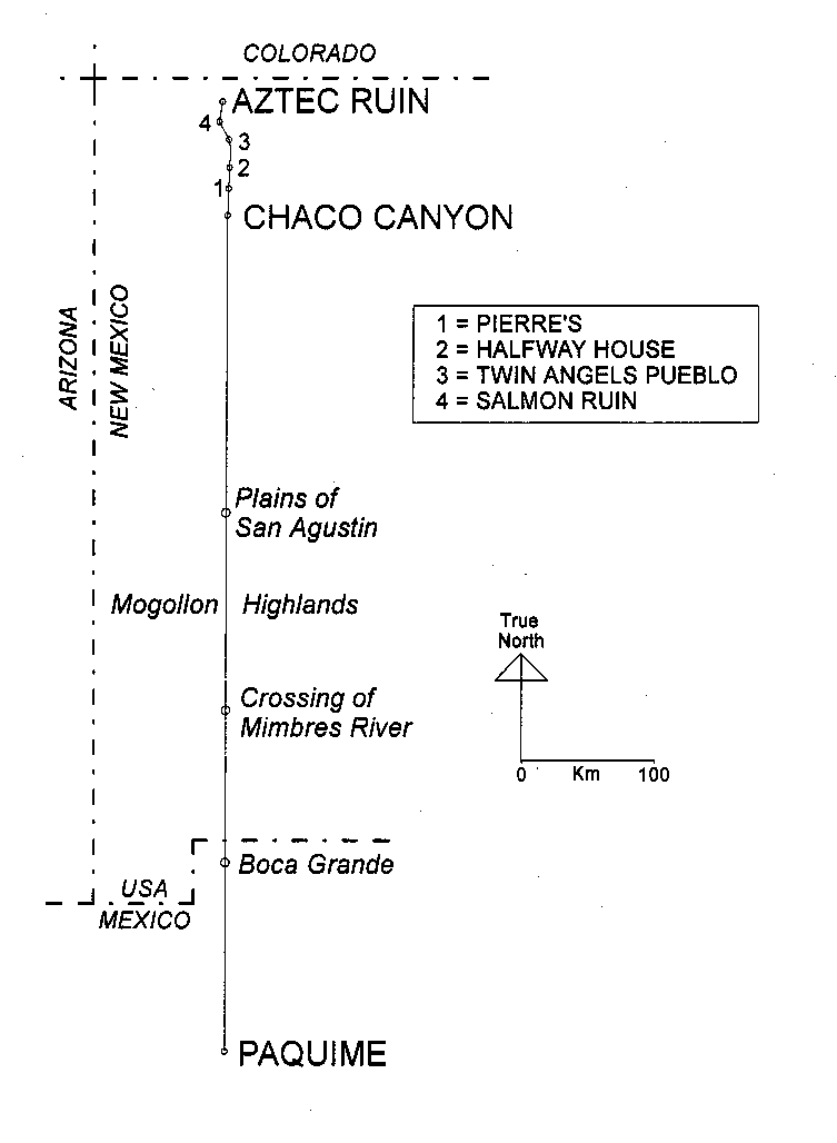
| Location | Longitude W | Latitude N | Comments |
| Center Place, Chaco Canyon | 107 57' 25" | 36 3' 30" | Based on local USGS 7.5 minute quadrangle. Longitude same as provided by Lekson (1999:113). |
| Salmon Ruin | 108 1' 36" | 36 42' 3" | Based on local USGS 7.5 minute quadrangle. |
| Mound F tri-wall, Aztec Ruins | 107 59' 53" | 36 50' 9" | Based on local USGS 7.5 minute quadrangle. Lekson's longitude value is 107 59' 50" (1999:113). |
| Paquimé | 107 56' 47" | 30 21' 58" | Based on CETENAL Nuevo Casas Grandes H13A71, 1:50,000. Lekson's longitude value from GPS readings is 107 56' 49" (1999:113). |