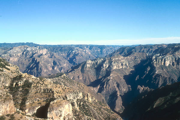
Zone 3: Barranca del Cobre, Chihuahua. Photo by Angus McIntyre,
used under a Creative Commons license.
David Phillips
As Figure 1 shows, Northwest Mexico has a rough mirror symmetry, the axis of which is the Sierra Madre Occidental. In terms of human culture history, the middle elevations west of the great sierra were the heart of Sonora, while the midde elevations east of the sierra were the heart of Chihuahua. Farther from the mountans, at lower elevations, the Sonoran and Chihuahuan Deserts limited the spread of ancient village life.
The modern biotic patterns emerged only after the arrival of humans. At the end of the Pleistocene, woodlands extended into what is now desert [Betancourt et al. 1990] and lakes were present in the closed basins of Chihuahua. The largest of these was Lake Palomas [Reeves 1969], in the basins now draining into Laguna Tildío, Laguna Guzmán, Laguna Santa María, and Salinas de la Unión. According to Hawley [1993], Lake Palomas covered up to 7,770 km2 and was up to 75 m deep. Castaglia and Fawcett's [2006] more recent estimates of the highstand are slightly smaller (5,600 km2, 29 m deep) but still impressive. Metcalfe et al. [2002] report that the Laguna Babícora was at least 19 m deeper than today.
Based on studies in the Babicora Basin, Ortega-Ramírez et al. [1998] posit a long drying trend (interrupted by the Younger Dryas stadial) from 12,000 to 6,000 years BP. Effective moisture then increased somewhat, to modern levels, but with short-term oscillations [Ortega-Ramírez et al. 1998, Figure 5]. Castaglia and Fawcett's [2006] data from Lake Palomas provide a complementary picture: multiple Holocene episodes of lake refilling, which they attribute to periods of El Niño-like conditions. Turning to finer-grained data, the tree-ring record examined by Díaz et al. [2002] does not extend back into prehistory, but shows that the erratic precipitation regime experienced today extends back to the 1600s (see also Enfield and Fernández T. [2006]). In summary, the prehistoric occupants of northwest Mexico had to deal with a climate as unpredictable as that of the U.S. Southwest. For additional information on regional paleoclimate, see Metcalfe et al. [1997, 2000].
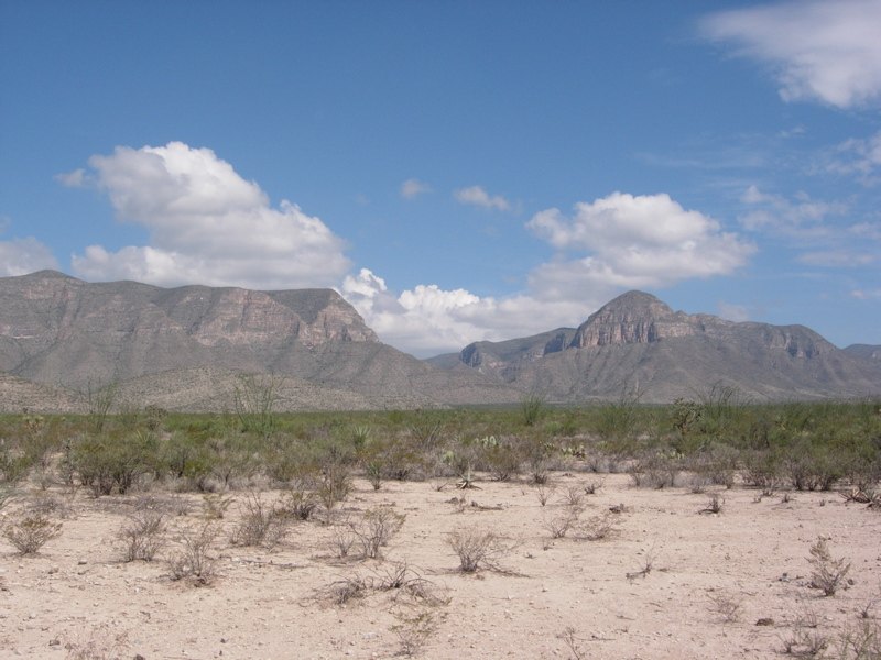
The Sierra Madre Occidental (Zone 3 in Figure 1) does not form an impenetrable barrier, but it is high enough (and rugged enough) to limit human interaction. As a consequence, historical trajectories east and west of the mountains were different. The sierra is a huge uplifted block of tuff, and in many places the overall skyline is almost flat (as the photo below shows). The tuff is easily carved by erosion, however, and travellers can find themselves threading a series of canyons and ridges. Elevations between the canyons often reach 2000 to 3000 m, and tall pine forests and winter snows are common. In the deeper canyon bottoms, in contrast, near-tropical conditions prevail.
Zone 3: Barranca del Cobre, Chihuahua. Photo by
Angus McIntyre,
used under a
Creative Commons license.
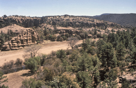
Zone 3: tall pines in Cave Valley, Chihuahua. Photo by D. Phillips.
Maxwell Museum Cat. No. 2007.80.506 (see end note).
Moving west in northern Sonora, the sierra gives way to basin and range country (sometimes called the Serrana). Basins can be narrow and the ranges prominent; upland elevations often reach 1000 to 2000 m. The streams of the main valleys tend to be permanent. Away from the rivers, lower elevations support scrubland and semidesert grassland. Hills are clad with oak and pine. (U.S. Southwesternists accustomed to a juniper-pinyon belt below the tall pines quickly learn that in and near the Sierra, this woodland belt is instead dominated by oaks. For detailed information on the region's biotic communities, please see Brown [1982].)
Historically, residents of the Serrana irrigated fields along the narrow valley bottoms and used the adjacent uplands for grazing. The Serrana was the focus of life in Sonora in historic times, and to a large extent in prehistoric times as well.
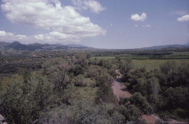
Zone 2: Rio San Miguel at Kino's home mission. Photo by D. Phillips.
Maxwell Museum Cat. No. 2007.80.46 (see end note).
In southern Sonora and northern Sinaloa, Zone 2 becomess a narrow belt of rugged hills, which are covered with subtropical thorn forest and deciduous forest. Local residents still practice slash-and-burn farming on slopes and plow the scattered pockets of bottomland. (Please click here to see images of the local agriculture.) While to the north, Zone 2 can be termed the heart of Sonora's prehistoric and historic occupation, this far south the middle elevations were a backwoods area, and human activity was concentrated on the coastal plains.
Farther west, Zone 1 is a belt of coastal lowlands. Here, the basins are broad and the intervening ranges low, dry, and isolated. Elevations commonly range between sea level and 1000 m. The Sonoran Desert, with its giant cacti, dominates Zone 1 in northern Sonora. In the southern part of that state, and in Sinaloa, the most common plant community is tropical thornscrub. Most streambeds are dry between heavy storms, but large rivers (such as the Sonora, Yaqui, and Mayo) are perennial and magnets for human life. In modern times, irrigation of the lower reaches of the large rivers has turned Sonora into an agricultural powerhouse, but prehistoric irrigation farmers seem to have preferred the upper (Zone 2) reaches of these rivers.

Zone 1: Sonoran Desert and Gulf of Calfornia (Sea of Cortez).
Source:
UNAM.
Most U.S. archaeologists do not think of coastal adaptations as part of the "Greater Southwest," but the culture area included such adaptations in Zone 1—including fishing, hunting, and the gathering of shellfish and salt for consumption and trade. The extreme aridity of most of the Sonora coast discouraged sedentism, however. Farther south on the west coast, the wetter climate and presence of mangrove swamps were more conducive to sustained human activity. Mangrove swamps are spotty in their distribution north of the Rio Mayo, but common from that river southward [Brown 1994:280].
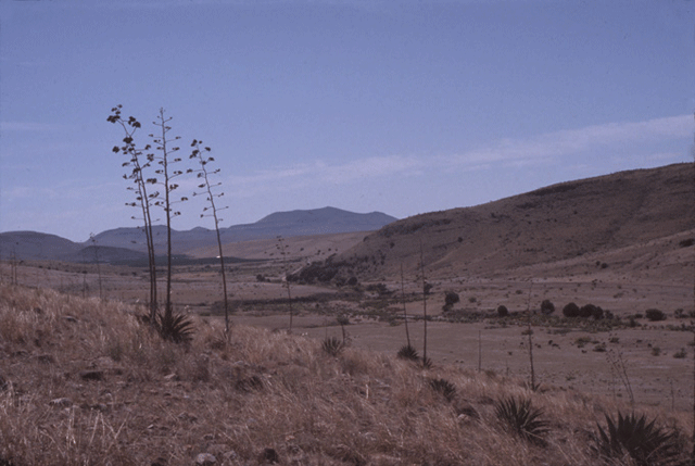
East of the Sierra Madre Occidental, Zone 4 resembles Zone 2 in having sometimes narrow basins separated by prominent mountains. Some of the basins are inward-draining, forming impermanent to semi-permanent lakes. (Before modern pumping of groundwater, the lakes may have been less evanescent.) The basins are dominated by grassland, the hills by oak. Elevations commonly range from 1500 to 2000 m. Just as Zone 2 was the focus of historic life in Sonora, Zone 4 was the focus for historic life in Chihuahua and northwest Durango.
Zone 4: arroyo La Tijaja, near Paquimé. Photo by D. Phillips.
Maxwell Museum Cat. No. 2007.80.33 (see end note)
Today, farmers in the southern (higher) basins of Zone 4 routinely plant maize in plowed fields on terraces, and variously depend on rainfall alone, or on rainfall supplemented by pump irrigation, to water their crops (see Ricketts 2008). Failures due to drought are common, but not common enough to discourage rainfall-dependent farming. Farther north, at lower elevations (in the vicinity of Nuevo Casas Grandes, for example), all modern farming is irrigation based.
Zone 4 wraps around the north end of the Sierra Madre and through the "boot heel" of New Mexico, to merge with Sonora's Zone 2. In the U.S., the Animas Mountains represent an ecological outlier of the Sierra Madre, though physically separated from the "mother range" by the Llano de Carretas. Sánchez de Carpenter and MacWillians [2006] provide an overview of the "boot heel" area's natural history. Citing evidence for post-Pleistocene Cloverdale Lake and Playas Lake, they argue for a period of intense summer monsoons to replace Antevs' [1955] Altithermal period.
Zone 5: Bolsón de Mapimí, Chihuahuan Desert.
Source:
UNAM
Zone 5 is the Chihuahuan Desert, dominated by creosote brush. Basins are shallow, wide, and almost continuous, while isolated ranges rise "like islands out of a sea" (Brand 1937:11). Many basins lack an outlet. Others drain into two great streams, the Conchos and the Bravo del Norte (Rio Grande). Elevations range between 600 and 1500 m. What passed for sedentary life understandably was limited to the two permanent streams, including at their junction (for a physical description of the latter, see Gardinier [1989]). East of the Conchos was a vast region of nomadic peoples who continued an Archaic lifeway until displaced or absorbed by the Spanish.
Photographs with catalogue numbers copyright © Maxwell Museum of Anthropology, University of New Mexico. High-resolution versons of these photographs may be ordered from the Maxwell Museum's photo archives. Please make note of the catalogue numbers. For more information please visit the photo archives web page