ISLETA
TO SAN ACACIA VEGETATION TRENDS
OVER
A TWENTY YEAR SPAN (’92-’12)
Background
The sections of river from the Isleta
Dam to the San Acacia Dam are considered Class 3b river maintenance reaches by
the Bureau of Reclamation (Reclamation). This classification means that if
there is erosion along most banks there is time to gather survey data and
complete a full stabilization design. For this stretch of river, the Technical
Services Division at the Reclamation is conducting a geomorphic analysis work.
A reach study has been requested from within the Reclamation to study various
aspects of the geomorphic conditions. Considerable work has been completed
along the stretch of river in this section.
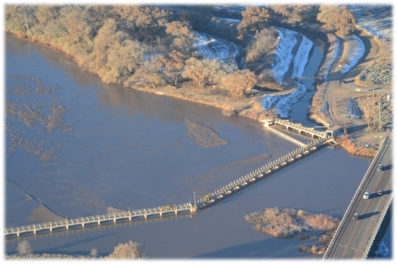
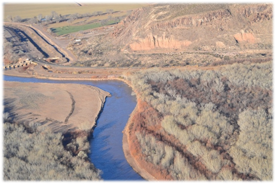
Isleta Dam
San Acacia Dam
The river has
a tendency to incise after construction is completed. This incision of the
river has produced taller banks so that flow does not reach on top of islands
and the floodplain as often. Without the flows inundating these areas,
vegetation grows thick so the islands and floodplains cannot be eroded and
transplanted.
This
project completed by Tony Lampert for CE 547 at UNM in the spring of 2016