ISLETA
TO SAN ACACIA VEGETATION TRENDS
OVER
A TWENTY YEAR SPAN (’92-’12)
|
CONCLUSION |
Conclusion
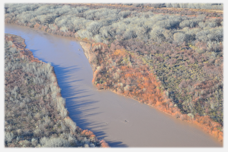
Image
classification used alongside digitizing area can be essential tools to verify
one another. In this case the trend of vegetation over time was the goal. The
time had already been put into digitizing before image classification was known
how to be utilized. In the twenty year
time frame from 1992 to 2012 there has been a significant increase in all
aerial photography checked of vegetated area in the active channel from Isleta
to San Acacia. The vegetated area has seen a 13.7% increase during that time
period. This trend will likely continue as the river remains to incise and peak
flows continue not to overflow sandbars and floodplains areas.
Future Work
The most
direct correlation to this work will be looking at bar trends along the same
section of the river. This will consist of digitizing active bars along the
river and the trends associated with this. This study will also include using
aerial photos from 1972 and 1985. Image analysis will also be used for this
method as well. The upstream and downstream boundaries will be the two dams,
while the lateral boundaries will be the river edge. There will also be work
looking into the channel slope, analysis of dominant arc wavelength, and
channel and floodway topography over approximately the same time period.
|
CONCLUSION |
This
project completed by Tony Lampert for CE 547 at UNM in the spring of 2016